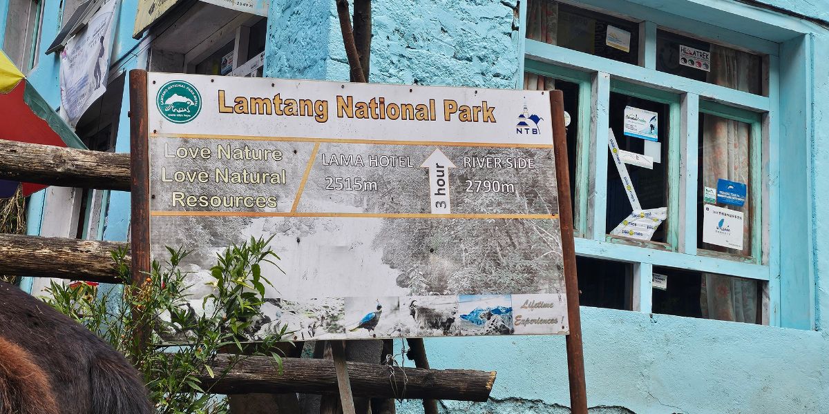
Langtang National Park’s name itself carries a story! In the local Tibetan-rooted language of the region, "lang" means yak, and "tang" means to follow. Together, this name means "the yak follows."
As per a local legend, a lama tracking his lost yak followed it deep into the valley, only to find the animal had died near what is now Langshisha Kharka! He skinned it and laid the hide out on a rock to dry, and that rock is still said to carry a reddish stain today.
Geographically, Langtang National Park spans three districts in Bagmati Province: Rasuwa holds the largest share at 56.6%, followed by Sindhupalchowk at 39.1%, and Nuwakot with the remaining 4.3%.
Between the 1,710 km² core area and the 418.3 km² buffer zone is spread across nine rural municipalities, all sitting closer to Kathmandu than any other Himalayan national park in Nepal!
I have personally trekked the Langtang Valley, Gosaikunda Lake, and Panch Pokhari routes. Well, each one left me with something the others did not:
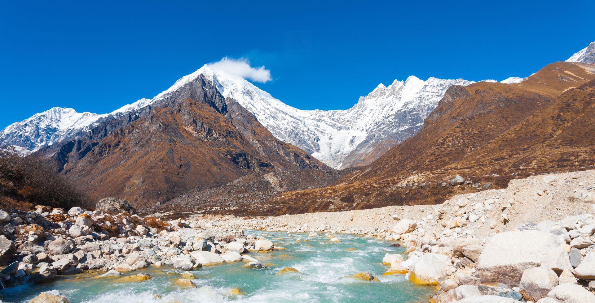
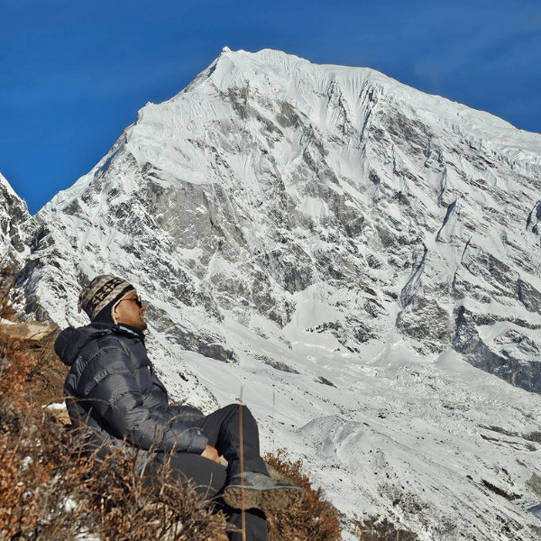
- Langtang Valley gave me glaciers, and Langtang Lirung's summit dominated the skyline for days straight. I have reached both Lower Kyanjin Ri and Tsergo Ri and genuinely loved the mountain views!
- Gosaikunda gave me the pilgrimage side of this park, watching people climb to 4,380 m purely out of faith. And I’ve personally taken a dip there in the monsoon month of Shrawan (around August)!
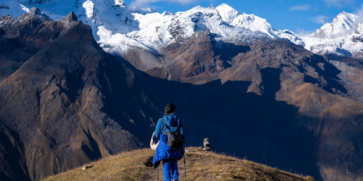
- Panch Pokhari was the choice for my first-ever solo trek. It gave me the quiet version of Langtang, a route where I barely crossed paths with other trekkers and the Jugal Himal felt entirely mine for a few days.
Beyond these three, there are other trekking routes that Langtang offers! Tamang Heritage Trail is where you can actually sit down and learn how families here have rebuilt since 2015. Or you can do the Helambu Circuit Trek with a short climb to Ama Yangri that shows how much reward this park packs!
In this detailed guide, I will walk you through everything you need to understand about Langtang National Park before you go: its geography and glaciers, its wildlife and ecological zones, the people who live inside its boundaries, the treks and peaks it offers, and the permits, costs, and timing you need to plan around.
I will also flag what has changed recently, including the access disruptions from the 2026 Bhotekoshi flood, so you are not planning around outdated information. Let’s begin!
Langtang National Park Quick Facts
|
Established
|
22 March 1976 AD, 9 Chaitra 2032 BS (Nepal’s first Himalayan national park)
|
|
Location
|
Bagmati province | Districts: Rasuwa - 56.6%, Sindhupalchowk - 39.1%, Nuwakot - 4.3% | Tibet border to the north
|
|
Core Park Area
|
1,710 km²
|
|
Buffer Zone
|
Covers 418.3 km², declared on 27 April 1998 AD (Baisakh 14, 2055 BS)
|
|
Main Entry Points
|
Dhunche, Mailung, Syaphru Bensi, Kutumsang, Magingoth, Tarkeghyang
|
|
Elevation Range
|
Under 1,000 m to 7,234 m (Langtang Lirung peak)
|
|
Ecological Zones
|
Tropical, Subtropical, Temperate, Sub-alpine, Alpine
|
|
Mountain Ranges
|
Langtang and Jugal Himal ranges
|
|
Main Lakes
|
Gosaikunda, Panchpokhari, Naukunda Lake clusters
|
|
Main Rivers
|
Langtang Khola, Bhotekoshi River, Trishuli Khola, Trishuli River, Melamchi River, Indrawati River, and Balephi Khola
|
|
Main Attractions
|
Trekking, peak climbing, wildlife, people and culture, festivals
|
|
Religious/Cultural Sites
|
Kyanjin Gompa, Sing Gompa, Gosaikunda, Panchpokhari, Ama Yangri
|
|
Main People
|
Tamang (majority), Hyolmo, Gurung, Newar, Sherpa, Bhotia
|
|
Notable Plants
|
Rhododendrons, Oaks, Pines, Firs, Birches, Lichens, Primulas
|
|
Notable Animals
|
Red panda, Snow leopard, Grey wolf, Musk deer, Tahr, Macaque
|
|
Notable Birds
|
Himalayan Monal, Golden Eagle, Satyr Tragopan, Ibisbill
|
|
Notable Livestock
|
Yak, Nak, Chauri, Horse, Mule, Sheep, Goat
|
|
Total Plant Species
|
1,043 species, 21 endemic species
|
|
Total Mammal Species
|
46 species
|
|
Total Bird Species
|
380 species
|
|
Main Treks
|
Langtang Valley, Gosaikunda, Tamang Heritage, Helambu Circuit, Panchpokhari, Jugal Himal
|
|
Best Time to Visit
|
Spring (March to Mid-June) and Autumn (Late September to Mid-December)
|
|
Permits
|
Langtang National Park permit (mandatory), Restricted Area Permit (situational)
|
|
Accommodation
|
Mountain lodges, homestays, camping
|
|
Access from Kathmandu
|
Typically 5-7 hours by road to Dhunche, Heli tours are also popular
|
Overview: Location and Landscape
The Langtang National Park is the closest Himalayan trekking area to Kathmandu. Most of the entry points are only 80-120 km away. So, you can reach the park with just 5 to 7 hours of driving!
History and Establishment
As you can see on the map, the highways from Kathmandu go north to China through the Rasuwagadhi/Kerung (currently inaccessible after the 2026 Bhotekoshi Flood) and the Tatopani/Kodari borders. The Langtang National Park is more or less located between these two highways, and this detail is important.
Historically, these routes have been used for trans-Himalayan trade for over 2500 years. Traders came from Tibet and beyond and used these routes to reach Kathmandu and eventually the kingdoms in present-day India.
They traded salt and rice, butter, sheep wool, woolen blankets, dried cheese (churpi), herbs, hunted wildlife, etc. for thousands of years!
As you can probably imagine, this is the most important factor that shaped how the Langtang region is today - the people living here, their language, lifestyle, religious beliefs, culture and tradition, local architecture, food and farming, and everything else.
Coming back to modern day Nepal, British mountaineer Major H.W. Tilman led the first official exploration of the region in June 1949. This paved the way for future scientific, trekking, and mountaineering expeditions, which eventually led to the establishment of the national park:
- 1970 AD - Following increased tourism in Langtang Valley in the last decade, the Government of Nepal approves a proposal to make Langtang a protected area.
- 1973 AD - Nepal enacts the National Parks and Wildlife Conservation Act 1973.
- 1974 to 1975 AD - Officials and experts consult with the locals, conduct boundary surveys, ecological assessments, and map the proposed park and its features.
- 26 March 1976 AD - Langtang National Park is established as Nepal’s first Himalayan national park and the country’s fourth protected area.
Over the next few decades, rangers were deployed for regulation, conservation, and rescue. Management plans were created, more surveys were done, a buffer zone was declared, and sustainable policies and tourism management plans were implemented.
The Gorkha earthquake of 2015 resulted in massive casualties and damage, but the region is slowly recovering.
Today Langtang National Park is a well-monitored protected area, safe for trekking and exploration, with official priorities on conservation of the endangered Himalayan ecosystem and biodiversity.
Where is Langtang National Park Located?
As mentioned earlier, Langtang National Park is located in the Bagmati Province in central Nepal and borders Tibet to the north.
Including the 1,710 km² core area and the 418.3 km² buffer zone, it’s spread over 3 districts and 9 rural municipalities.
Note: Do not confuse the Buffer Zone User Committee (BZUC) names with the local ward or rural municipality names, as they are distinct entity designations. For example, the BZUC named Naukunda is not the same as Naukunda Rural Municipality; it is simply a committee name, whereas the actual ward name of Gosaikunda RM-6 is "Dhunche". Similarly, Suryakunda is only a BZUC name and not the name of that ward, as the actual Suryakunda Lake is located in Dupcheshwor Rural Municipality, Nuwakot.
Rasuwa District - 56.6%
|
Buffer Zone User Committee (BZUC)
|
Rural Municipality - Ward
|
|
Timure
|
Gosaikunda RM-2
|
|
Briddhim
|
Gosaikunda RM-3
|
|
Langtang
|
Gosaikunda RM-4
|
|
Suryakunda
|
Gosaikunda RM-5
|
|
Naukunda
|
Gosaikunda RM-6
|
|
Ramche
|
Kalika RM-1
|
|
Dhaibung
|
Kalika RM-2
|
|
Laharepauwa
|
Uttargaya RM-5
|
|
Yarsa
|
Naukunda RM-1
|
|
Saramthali
|
Naukunda RM-3
|
|
Bhorle
|
Naukunda RM-5
|
Sindhupalchowk District - 39.1%
|
Buffer Zone User Committee (BZUC)
|
Rural Municipality - Ward
|
|
Hyolmo Ama Yangri
|
Helambu RM-1
|
|
Redpanda
|
Helambu RM-2
|
|
Homacho
|
Panchpokhari Thankpal-2
|
|
Dorje Lakpa
|
Jugal RM-3
|
|
Lengsi
|
Jugal RM-2
|
Nuwakot District - 4.3%
|
Buffer Zone User Committee (BZUC)
|
Rural Municipality - Ward
|
|
Kalpeshwori
|
Tadi RM-1
|
|
Indreni
|
Dupcheshwor RM-1
|
|
Pangbochethan
|
Dupcheshwor RM-2
|
|
Dupcheshwori
|
Dupcheshwor RM-6
|
|
Bachaladevi
|
Dupcheshwor RM-7
|
Entry Points of Langtang
The main entry point and park headquarter is at Dhunche. But depending on where you’re approaching from and what trek you’re doing, you may prefer one of these entry points:
- Rasuwagadhi/Kerung - The international border with Tibet and the entry point for people coming in from the Tibet side.
- Syaphru Bensi - The entry point for people coming in from the west (Dhading’s Ruby Valley area), now affected after the flood.
- Dhunche - Main entry point when approaching from the south (visitors from Kathmandu and elsewhere). Leads to Syaphru Bensi.
- Mailung - Alternative entry point for visitors from the south that leads to Syaphru Bensi (now affected after the flood).
- Shikharbesi - Low-traffic entry point in the Nuwakot district that leads to the Gosaikunda trail.
- Kutumsang - Entry point at the border of Nuwakot and Sindhupalchowk that connects the Helambu and Gosaikunda areas.
- Timbu - Entry point in the Melamchi area, which acts as a gateway to the Helambu region.
- Sermathang - Traditional village that serves as an entry point to Ama Yangri peak.
- Thangpal - Entry point to the Panchpokhari area with a recently constructed range post at Dukhang Kharka.
- Chautara - Serves as the headquarters of the Sindhupalchowk district and an alternative entry point to the Panchpokhari and Jugal areas.
- Tembathang - Entry points to the Jugal and Panchpokhari areas for visitors coming in from the east side.
Latest Langtang Trek Update: Rasuwagadhi, Syaphru Bensi, and Mailung are inaccessible after the 2026 Bhotekoshi flood. So, use these alternative routes for entry.
Landscape and Geological Formation of Langtang
The Langtang and Jugal mountain ranges form a core part of Nepal’s central Himalayas. They stretch from the Kerung border crossing in the west to Kodari in the east. In doing so, they form a massive natural barrier that separates Nepal and Tibet.
From west to east, some notable peaks that make up this boundary include Langtang Lirung (7,234 m), Yubra (6,048 m), Shalbachum (6,682 m), Langtang Ri (7,205 m), Risum (7,050 m), Ramthang Karpo Ri (6,865 m), Loenpo Gang (6,979 m), Phurbi Chyachu (6,631 m), etc.
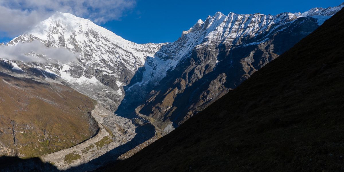
At the foothills of the Langtang range lies Langtang Valley, with notable locations like Langtang village, Kyanjin Gompa, and Langshisha Kharka.
Directly at the valley’s south side is another mountain range that extends from the Gosaikunda area till Dorje Lhakpa peak (6,966 m). Notable peaks include Baden Powell Scout Peak (5,857 m), Naya Khanga (5,863 m), and Ganchenpo (6,378 m).
All these peaks and ranges have more or less defined the landscape and geology of the entire region:
- They separate Tibet from Nepal and areas like Langtang Valley, Gosaikunda, Panchokhari, and Jugal from one another.
- Major rivers of the region like Bhotekoshi, Langtang Khola, Melamchi, etc. originate from the glaciers of these peaks.
- Snowmelt, rain, and underground springs near these ranges have led to the formation of alpine lake systems like Gosain Kunda. These lake systems then go on to feed major rivers like Trishuli.
- In satellite view, you’ll notice these ranges branch out like tree roots. This shape is a natural result of the collision of tectonic plates and millenia of fluvial erosion. All of this forms countless layers of hills, which eventually even turn to flat valleys.
- The lowlands (especially Nuwakot Valley) are very fertile thanks to the countless river systems that bring minerals all the way from the mountains.
Buffer Zone of Langtang National Park
The buffer zone is a protective zone surrounding the core park area. This region consists of forests, farmlands, and villages outside the park as well as some settlements enclaved in the core park area.
The purpose of this zone is to mitigate human impact on the park while empowering local communities. This is done by letting them help with the conservation of the park through participatory management.
Unlike the core park area, locals in the buffer zone can participate in firewood collections, livestock grazing, and similar activities in a regulated manner.
Similarly, 30-50% of the park revenue is channeled to local communities and spent on things like conservation education and activities, community development, skill building programs, etc.
You’ll notice the boundaries and entry points clearly in the above map. Places like Kutumsang or Shikharbesi serve as entry points to the core park area.
But if you just want to explore the buffer zone areas south of them, you can do so without any permits! After all, these lower areas are still very beautiful and interesting.
The 2015 Earthquake and Langtang’s Recovery
The Langtang region was one of the hardest-hit regions during the 2015 earthquake.
The 7.8 magnitude earthquake on April 25 triggered a massive landslide that swept away most of Langtang village. Not only was one of the most iconic settlements of the region destroyed, it caused 300+ deaths on the spot.
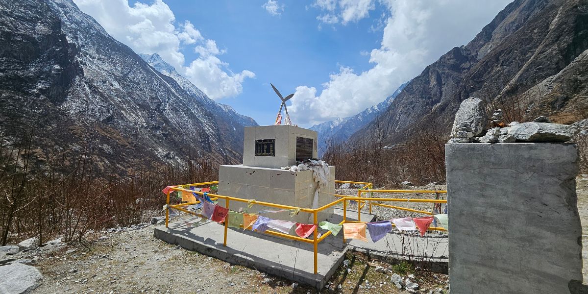
Subsequent aftershocks added to the destruction of 15 security posts, 55 teahouses, various cultural sites, and portions of trekking trails.
Visitor numbers dropped by 74% in 2016 to only 4,292 trekkers. The locals had lost their homes and family, and now their livelihood as well.
Thankfully, resilience is ingrained in the Nepali blood:
- The locals and officials started rebuilding with earthquake-resilient construction methods.
- They worked on restoring damaged infrastructure, cultural sites, etc. Also, they rerouted some trekking trails away from landslide-prone zones.
- They set up GIS-based Disaster Information Management Systems, piloted early-warning systems, and created a Disaster Risk Reduction community.
Political instability and COVID-19 didn’t make things any easier. But now, a decade later, Langtang has bounced back incredibly with over 10x the visitor numbers of 2016.
It is an excellent symbol of Nepali resilience - how the people here never give in to despair and keep persevering despite all the hardships of the mountains.
Ecological Zones and Climate
You’ll find 5 ecological zones in the Langtang National Park if you travel under 1,000 meters and climb to above 4,000 meters.
Tropical (under 1,000 m)
Representing the lowest elevation zone within Langtang National Park, this tropical zone experiences the warm, humid climate typical of the lowland river valleys.
This narrow ecological belt serves as a critical transition area where dense broadleaf forests thrive, forming the baseline climatic floor of the park before ascending into cooler, temperate mountain regimes.
Here are the details:
- Climate: Warmest zone in the park; full monsoon exposure (Late Jun - Mid Sep); driest months typically Nov–Apr (however, snow prone in high altitude places).
- Physiography: Confined to a narrow pocket in the SW corner (lower Bhote Koshi and Trishuli valleys near Ramche).
- Topography: Low valley floor; V-shaped river gorges cut by fast-flowing rivers on boulder substrate.
- Terrain type: Riverine lowland, steep-sided gorge margins
- Soil characteristics: Fertile loamy soil
- Vegetation types: Sal (Shorea robusta) is dominant and has its own dedicated conservation zone (Bandare Tropical Vegetation Conservation Zone)
- Species adaptation: Sal is a lowland broadleaf species intolerant of frost. Its presence marks the genuine climatic floor of the park.
- Fauna: Crop raiders like Assamese monkey, wild boar; predators like leopard (common and clouded), black bear; and heavily hunted species like serow.
Subtropical (1,000 - 2,000 m)
Above the riverbeds lies the subtropical zone of the park, which includes the mid-hill slopes and river valleys.
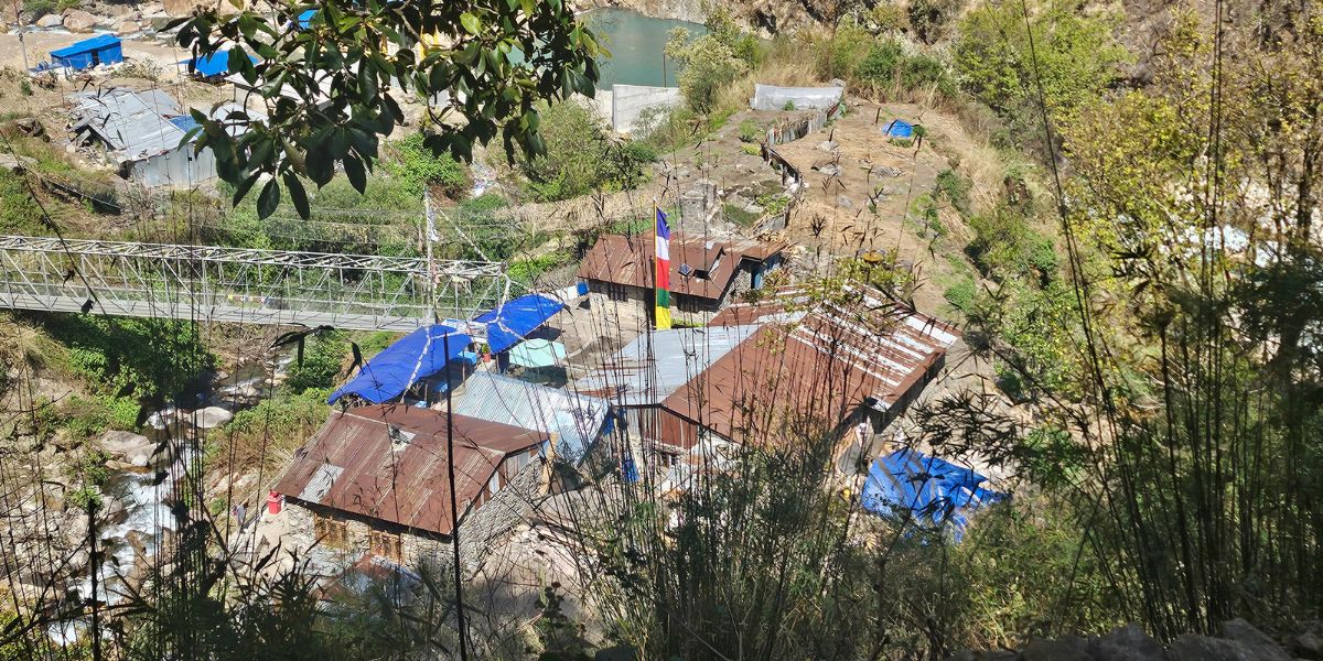
The ecological belt possesses a warm temperate climate strongly influenced by the summer monsoon and is distinguished by a diverse mosaic of damp broadleaf forests in protected ravines and drier pine stands on exposed, rocky ridges.
Here are the highlights:
- Climate: Warm-temperate; monsoon-influenced; damper in valleys along lower Trishuli, Melamchi, Larke, Panchpokhari Khola, and Bhotekoshi.
- Physiography: Mid-hill slopes transitioning from valley floor to steeper terrain.
- Topography: Mix of damp lower slopes and drier, rockier terrain (Dhunche–Timure corridor).
- Terrain type: Rolling hillside, cultivated terraces near settlements, rocky drier slopes elsewhere.
- Soil characteristics: Loamy soil is still predominant.
- Vegetation types: Chilaune (Schima wallichii) and Uttis aka Nepalese Alder (Alnus nepalensis) in damp areas; Chir pine (Pinus roxburghii) on drier rocky slopes; shrub layer of Berberis aristata, Rubus spp., wild rose, with Eupatorium and Artemisia vulgaris herbs on heavily grazed ground.
- Species adaptation: Chir pine tolerates dry, rocky, fire-prone slopes; shrub species in this zone are largely grazing-tolerant/disturbance-adapted, reflecting heavy winter livestock congregation and fodder extraction here.
- Fauna: Same animals as the tropical belt, but now you start to see more Langurs and Ghorals too.
Temperate (2,000 - 3,000 m)
Ascending into the mid-to-upper hill slopes, the temperate zone marks a noticeable drop in temperature and a strong influence from mountain topography and aspect.
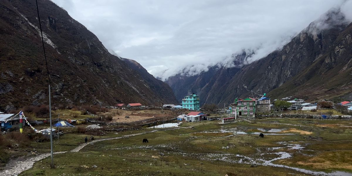
This belt is distinguished by dense oak, hemlock, and rhododendron forests. Cool, humid conditions prevail on shaded north-facing slopes; drier, more open forest compositions occur on exposed southern aspects.
Here’s what you should know about this climatic zone:
- Climate: Cooler, more humid on shaded/north aspects ("damp, muggy, shaded" upper temperate); drier on exposed south-facing slopes.
- Physiography: Mid-to-upper hill slopes; this is where the underlying nappe/dip structure starts to matter.
- Topography: Steeper, more stable south-facing slopes in Langtang valley vs. less steep but more erosion-prone, forested north-facing slopes. This is a direct consequence of geological dip direction.
- Terrain type: Steep forested hillside, transitioning gorge-to-slope terrain.
- Soil characteristics: Increasingly acidic (pH 5–6); transitional between the lower loamy-sands and upper skeletal/podosol soils.
- Vegetation types: Oaks (Quercus semecarpifolia, Q. lamellosa, Q. lanata) dominant, with Rhododendron arboreum; Blue pine patches (upper Bhote Koshi, lower Langtang/Lendi); Spruce (Picea smithiana) in Lendi Valley; Hemlock in shaded, damp pockets; bamboo thickets in the understory.
- Species adaptation: Broadleaf evergreen oaks dominate on more stable slopes; conifers (spruce, hemlock) favor cooler, moister, shaded niches.
- Fauna: Himalayan black bear ranges widely (frequent human conflict); Common leopard fairly common, preying on langurs.
Subalpine (3,000 - 4,000 m)
Approaching the upper forest limit, the subalpine zone experiences a cold-temperate climate with heavy winter snow cover.
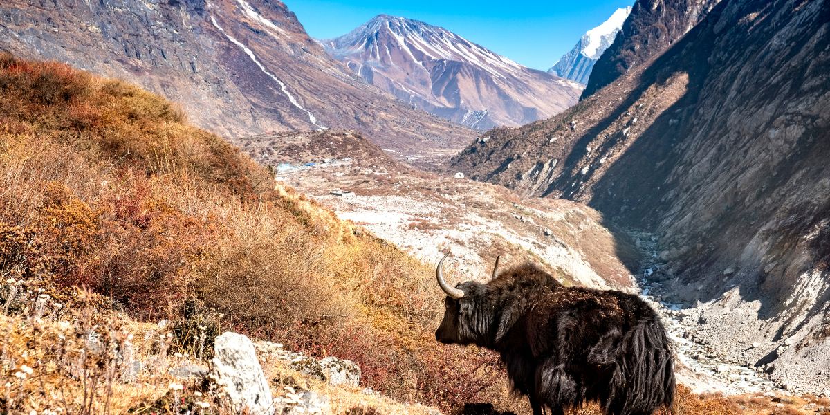
This high-altitude belt represents a dramatic transition where dense conifer stands (dominated by silver fir, hemlock, and larch) gradually break into dwarfed rhododendron thickets, birch bands, and open scrub as the treeline nears.
Here are the details of this climatic zone:
- Climate: Cold-temperate, snow in winter.
- Topography: Steeper upper-valley slopes approaching treeline.
- Soil characteristics: Podosol soils characteristic between ~3,500–3,700 m on less-steep terrain; alternating dark/pale ash-horizon layers where pasture-burning occurs (subalpine Langtang pastures), with more homogeneous pH there.
- Vegetation: Conifer-dominated. Hemlock, Silver fir, Rhododendron barbatum mixed with maple on moist N/W slopes; Caragana and Juniperus recurva with R. campanulatum on drier south-facing slopes.
- High Vegetation: Rhododendron anthopogon, Juniperus indica, Ephedra gerardiana, willows, sea buckthorn, Caragana; Nepalese larch (Larix nepalensis) and Langtang Larch (Larix himalaica), and Birch below the treeline; a distinct Birch-Rhododendron band around 3,800 m.
- Terrain type: Treeline ecotone (forest breaking into scattered stands and scrub).
- Species adaptation: Larch's deciduous habit (shedding needles) is a specific cold/snow-load adaptation rare among conifers; dwarfing and prostrate growth forms appear in the upper band as wind exposure increases.
- General soil note (park-wide): In the upper valleys generally, weathering is rapid and soils are young/skeletal; boulder scree and lateral moraine sand form skeletal soils around glacier margins.
- Fauna: Red panda (often sighted around Polangpati, Ghodatabela, Cholangpati, Magingoth, Panch Pokhari), Red fox, Pheasants, Musk deer, Himalayan black bear, etc.
Alpine (above 4,000 m)
Extending above the treeline to the permanent snowline, the alpine zone is defined by harsh climatic conditions, including extreme cold, high winds, intense solar radiation, and a very short growing season.
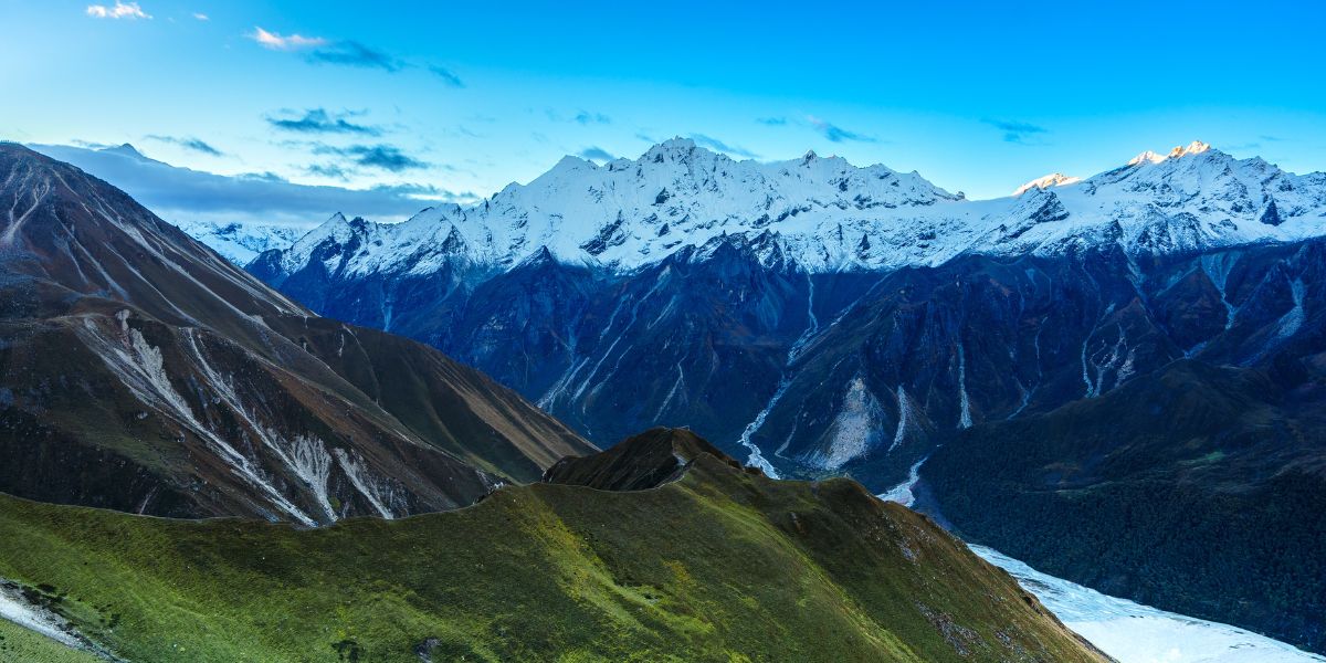
Forest vegetation disappears entirely in this high-altitude realm, giving way to dwarf shrubs, cushion plants, and vast high-altitude meadows adapted to survive on exposed, skeletal soils and glacial moraines.
Here are the details of this zone:
- Climate: True alpine with sub-zero temperatures much of the year, high UV, high wind exposure, short growing season.
- Physiography: Highest zone below permanent snow/rock; U-shaped glacially carved valleys with lateral/terminal moraine deposits.
- Topography: U-shaped valleys with marine/glacial deposits typical at this elevation (contrasting with V-shaped gorges lower down); Langtang Valley itself shows a combined U+V cross-section where the river has cut further into the glacial valley floor.
- Terrain type: Glacial trough, moraine field, scree slope, alpine meadow.
- Soil characteristics: Skeletal soils dominate (thin, young, rocky, forming directly on boulder scree and lateral moraine).
- Vegetation types: Lower alpine (4,000–4,500 m): Ephedra gerardiana, Myricaria rosea, Hippophae tibetana, dwarf willows, Rhododendron nivale, and R. anthopogon; Upper alpine (4,500–5,000 m): true alpine meadow: Primula and Potentilla herb communities.
- Species adaptation: Ground-hugging, cushion-forming, and dwarf-shrub growth forms throughout, a classic wind/cold avoidance strategy; herbaceous meadow species at the top edge rely on a short, intense summer growing season.
- Fauna: Snow leopards (upper Langtang, Yangri, Lendi valleys), Himalayan tahr (key prey species, south-facing slopes), Great Tibetan sheep (suspected near Tibet border), red fox (3,300–5,300 m).
Geography and Natural Landscapes
The Langtang Region is a mix of valleys, ridges, glaciers, peaks, lake basins, villages, and river systems. The cohesion of all these natural elements in a single region is a wonder in itself!
Below are the detailed descriptions of each of these natural gifts residing in this spectacular region.
Valley Formation and Terrain
Whenever the topic of Langtang’s terrain comes up, it generally starts with the same collision that built the entire Himalayan range!
We all know about the Indian plate pushing into Asia in the Eocene, something that is still happening today. In this process, it drove the deep crustal rock upward and exposed it to the surface over millions of years.
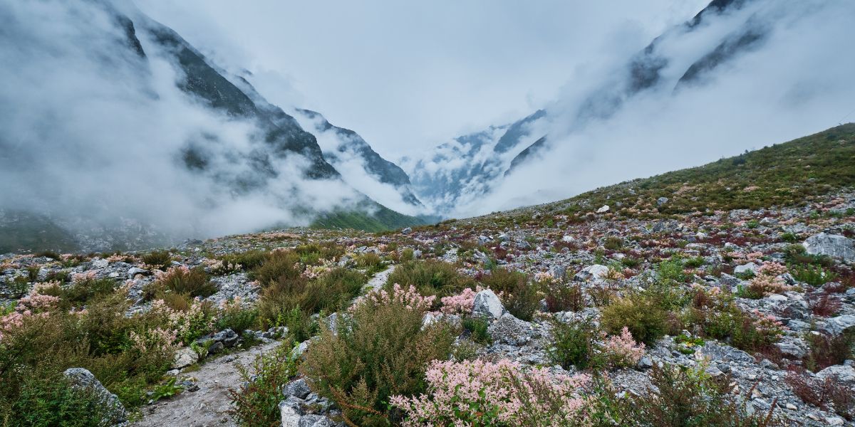
And that is where Langtang National Park happens to sit: one of the finest exposed cross-sections of this process anywhere in the central Himalaya.
Digging deeper into the terrain and valley formation of Langtang National Park, the park happens to have three crucial rock layers stacked on top of each other, which are as follows:
- Top Layer: High-grade rocks like gneiss, migmatite, and granite.
- Middle Layer: The Main Central Thrust (MCT) Shear Zone, a massive ductile fault line where high-grade rocks were pushed over lower-grade ones.
- Bottom Layer: Lower-grade rocks like schists, phyllites, and quartzites.
So, this sums up how the Langtang National Park valley was formed, to an extent!
Mountains and Peaks
If you are wondering about the catalogue of mountains that Langtang has in store, then you would be surprised!
A region so close that also holds a plethora of magnificent mountains and peaks has to be a plus point indeed. Similar to any other trek, Langtang’s experience also heavily revolves around its mountains. You get a shift of scenery while you're traversing through the routes.
Langtang Himal dominates the upper Langtang Valley, whereas Jugal Himal has the domain in the eastern regions (Panch Pokhari/Helambu).
Note: Ganesh Himal sits to the west (Nagthali Ghyang/Ama Yangri Ridge); however, it is not within the Langtang National Park boundary.
On clear days from Tsergo/Tserko Ri, even Shishapangma appears across the Tibetan border.
Langtang Himal Range
The Langtang Himal forms the northern wall of the park and runs more or less parallel to the Nepal-Tibet border. It is the range you will spend most of your time looking at if you do the Classic Langtang Valley Trek, since it rises almost directly above Langtang village and Kyanjin Gompa.
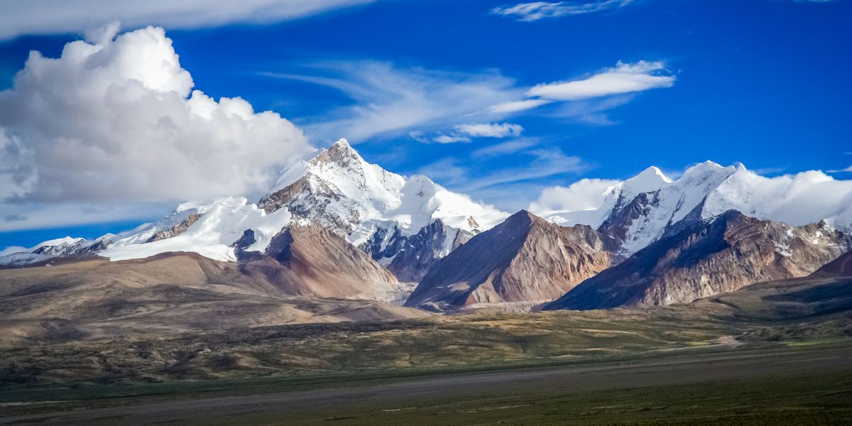
From west to east, the range includes these main peaks: Langtang Lirung (7,234 m), Yubra (6,058 m), Salbachum (6,707 m), Langtang Ri (7,205 m), Peri (6,174 m), Pem Thang Karpo Ri (6,865 m), Ghanja La Chuli (5,863 m), etc.
Langtang Lirung is the highest point in the entire park at 7,234 m, and it dominates the skyline from almost every village in the upper valley!
Jugal Himal Range
Jugal Himal sits east of Langtang Himal, above the Panch Pokhari and Helambu areas, and it sees far fewer visitors. This is partly geography and partly access.
The trails here are rougher, the villages are smaller, and most trekking companies simply route very few clients through this side of the park.
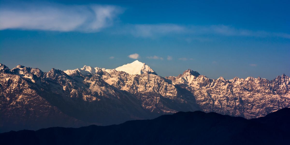
The range's highest point is Loenpo Gang (6,979 m), with Dorje Lhakpa (6,966 m), the more famous one, at #2. In fact, Dorje Lhakpa is usually described as the range's signature summit because it is visible from Kathmandu and Nagarkot on a clear day.
Other notable peaks include Bhairab Takura, also called Madiya Peak (6,799 m), Phurbi Chyachu (6,631 m), and Gyalzen Peak (6,151 m).
The best trek I would recommend to see the Jugal Himal range is Panch Pokhari, as it gives you access to this range along with the cluster of five ponds, without the crowds you will find on the main Langtang trail!
Or if you’re fine with a more remote trail, Jugal Himal Base Camp would be great!
Main Glaciers
The region is nicknamed the 'Valley of Glaciers' due to its numerous glacial bodies, like Langtang Glacier and Langshisha Glacier, which basically shape the entirety of the Langtang region.
The park holds around 17 named glaciers, which makes it one of the most glacier-dense protected areas in Nepal outside the Everest and Kanchenjunga regions.
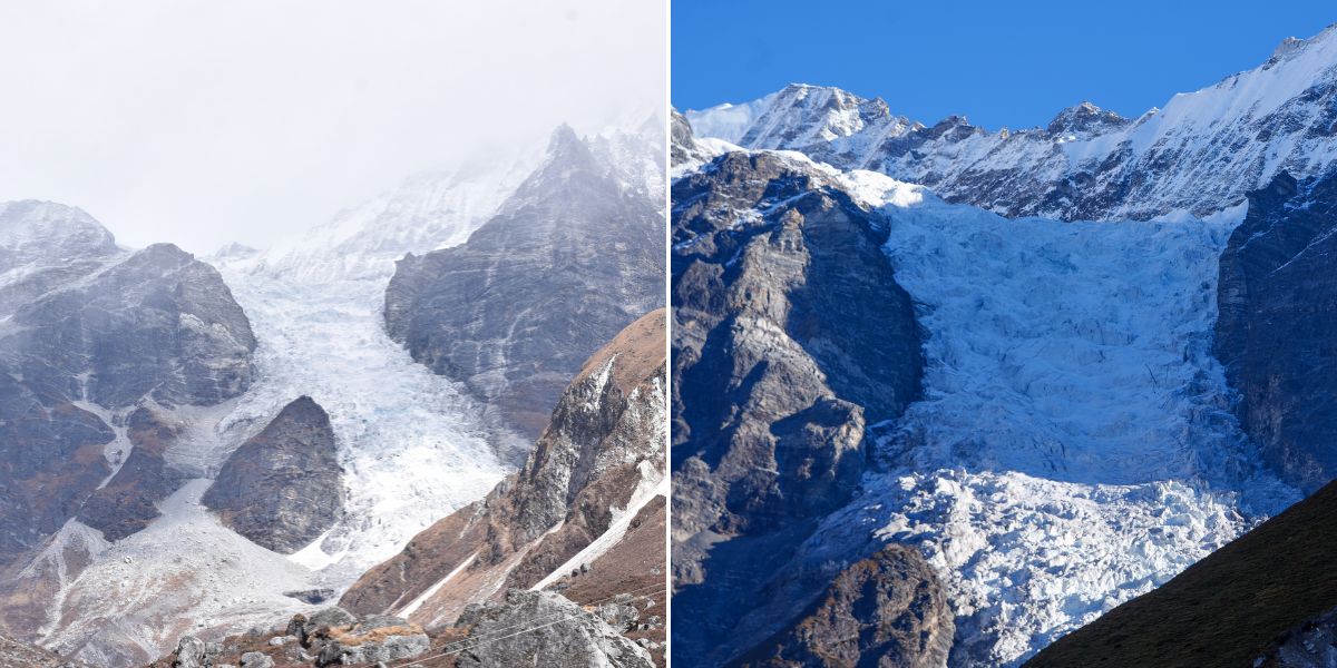
The largest is the Langtang Glacier itself, a valley glacier roughly 18 km long covering about 46.5 km², extending between elevations of 4,500 m and 7,000 m. It controls much of the water flow in the upper valley!
The Langshisha Glacier, at the head of the valley past Kyanjin Gompa, is the second major system, and it feeds the Langshisha Kharka area that many trekkers use as a high-altitude side trip. If you book our 8-day Langtang package, you’ll get to visit there!
Other glaciers worth knowing about:
- Lirung Glacier, flowing off the southern face of Langtang Lirung, has been studied extensively for its debris cover and rapid retreat, and it is one of the most closely monitored glaciers in the Himalayas.
- Yala Glacier, smaller and tucked north near the Tibet border, sits close to Yala Peak and has also been a long-term subject of glaciological research. Sadly, in May 2025, it was officially declared “dead”.
- Shalbachum Glacier, a large valley glacier that once extended all the way down to the Langtang River.
- Kimshung Glacier, feeding into the valley along the eastern flank of Tsangbu Ri.
I want to be honest with you here: these glaciers are shrinking. A 2026 study on the Langtang catchment found that the glaciated area has shrunk by roughly 41.5% since the Little Ice Age (around 1815 CE), and the retreat has accelerated in the last few decades due to global warming.
So, if you have wanted to see a genuine Himalayan glacier up close, I suggest not waiting another decade to do it!
River System
The Langtang and Jugal ranges do more than shape the skyline. Snowmelt and glacial meltwater from these ranges feed almost every major river system in this part of central Nepal.
Langtang Khola and Bhote Koshi River of Rasuwa
The Langtang Khola originates after multiple streams coming from Langtang and Langshisha glaciers (one of which is Bhemdan Khola) join at the upper valley (above Langshisha Kharka).
This river runs the length of the valley before joining the Bhote Koshi River at Syaphru Bensi. On the way, many other streams feed it (like Chandampari Khola, Kyampu Khola, Tanmarche Khola, Chopche Khola, etc.).
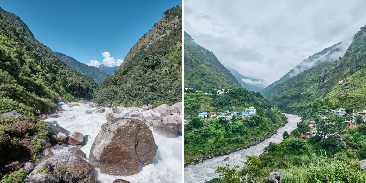
The Bhotekoshi River that serves as the western boundary of Langtang in Rasuwa starts from the Rasuwagadhi border, where the Lende Khola and Kyirong Tsangpo (both coming from Tibet) join. Along with Langtang Khola, other streams (like Ghatte Khola, Simlum Khola, Phenlun Khola, Palpuchhe Khola, Briddhim Khola, Chilime Khola, etc.) are tributaries of the Bhotekoshi.
Trishuli Khola and Trishuli River
When Bhotekoshi reaches a little beyond Thulo Bharkhu (near Dhunche), the Trishuli Khola flowing from the sacred Gosain Kunda Lake joins here, and the same river is now called “Trishuli River”.
Many guides may mention that the Trishuli River starts from Syaphru Bensi or that the same Bhote Koshi is also called Trishuli. However, the truth is that the source of Trishuli is Gosain Kunda, and only after the holy waters of Trishuli Khola meet the river near Dhunche can it be called “Trishuli River”.
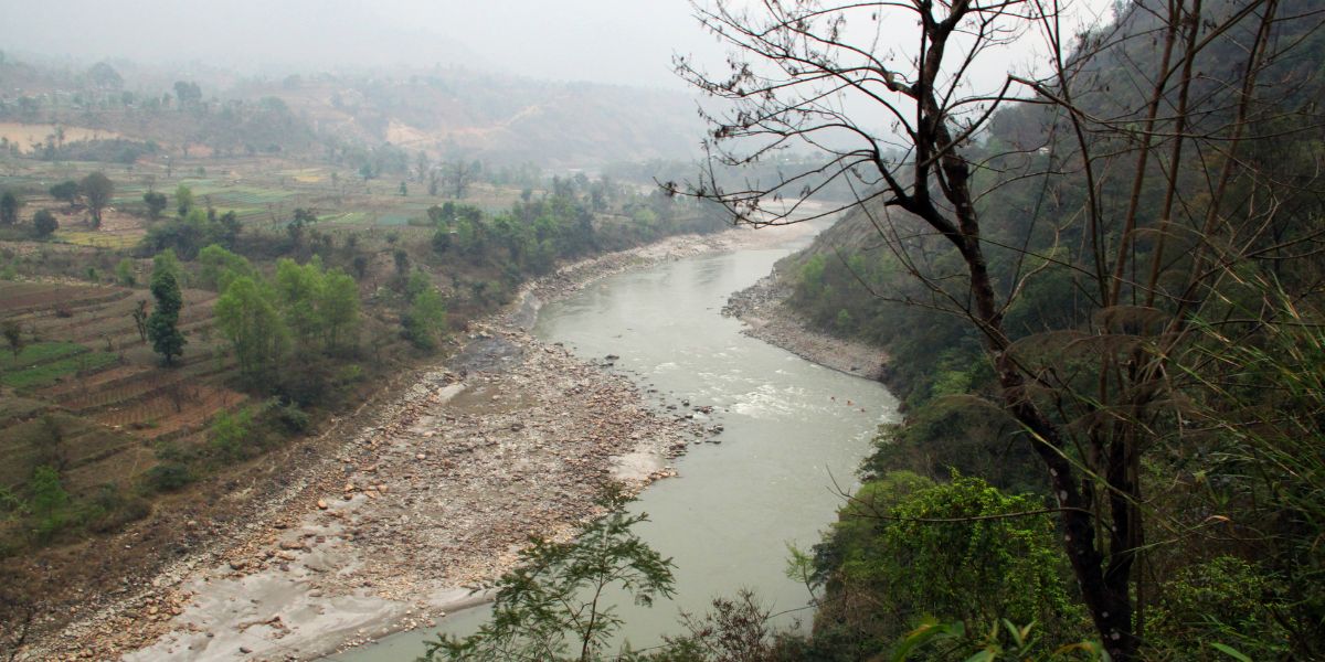
Yes, this is the same Trishuli that meets Marshyangdi River (that later joins the Narayani and then the Gandak River of India), running beside the Trishuli Corridor (National Highway 42).
It is also a popular white-water rafting destination downstream of the park (Charaudi-Kurintar).
Melamchi and Indrawati Rivers
Coming to the Helambu side, the main one here is the Melamchi River that currently serves as Kathmandu Valley's major water supply!
Its origin is the glacial waters from the Jugal Himal Range, beneath the peaks of Gochenpo, Baden-Powell Scout Peak, and Naya Khanga. On the way down, other streams join it (like Namsan Khola, Kamlung Khola, Jausing Khola, Fadung Khola, etc.)
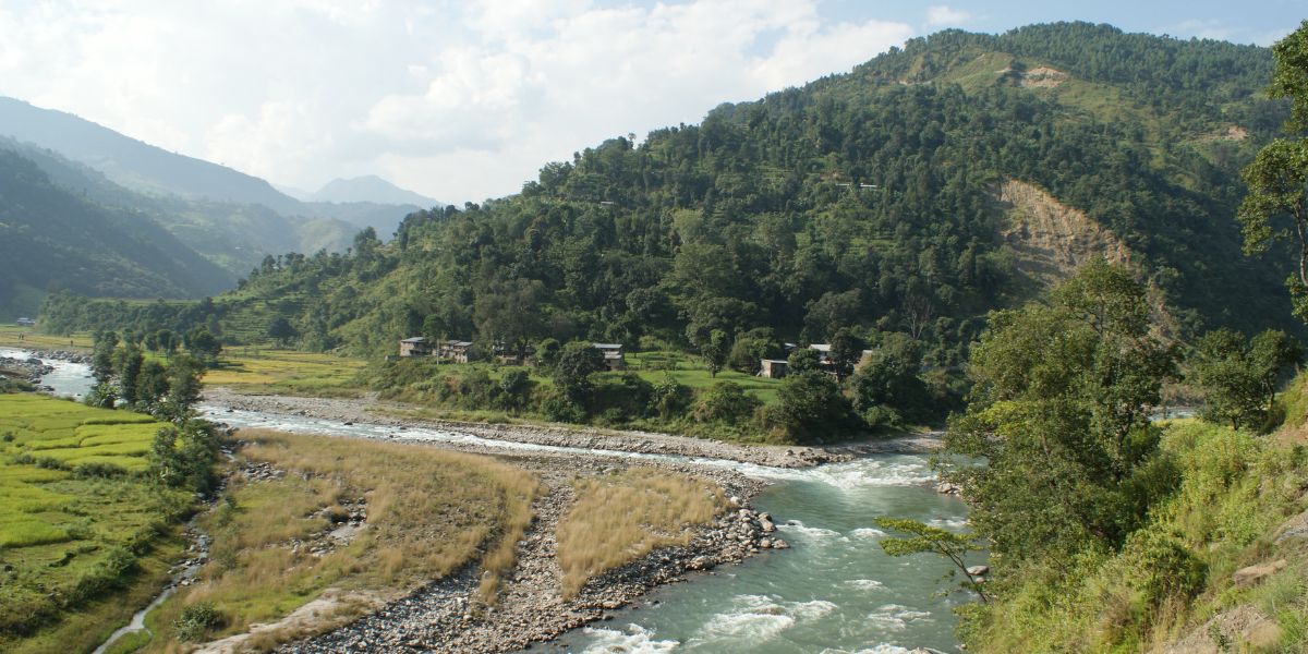
After reaching Melamchi Bazaar, it joins the Indrawati River, which then continues to flow outside the Langtang National Park and reaches Dolalghat. Here, the Indrawati mixes with the Sun Koshi River.
The source of the Indrawati River is somewhere near the Shiva Temple of the Panch Pokhari region (not the actual ponds, but somewhere close by). Before meeting Melamchi, it’s fed by multiple other streams, some of which are Gyalsin Khola, Ksumti Khola, Larke Khola, Yangri Khola, Hadi Khola, etc.
Balephi Khola: The Eastern Boundary of Langtang
It’s the Balephi Khola that runs beside the parts of Jugal Himal Base Camp trail that serve as the eastern boundary of Langtang National Park, separating it from the Gaurisankhar Conservation Area.
This river is fed by the glaciers of Jugal Himal range, and on the way to Kadambas (right beside the Araniko Highway, where it joins with the Sun Koshi River), many other streams join it. These include Yamblin Khola, Ghinlun Khola, Mayun Khola, Dune Khola, Lapse Khola, Sun Khola, Taptu Khola, Baramchi Khola, etc.
High-Altitude Lakes
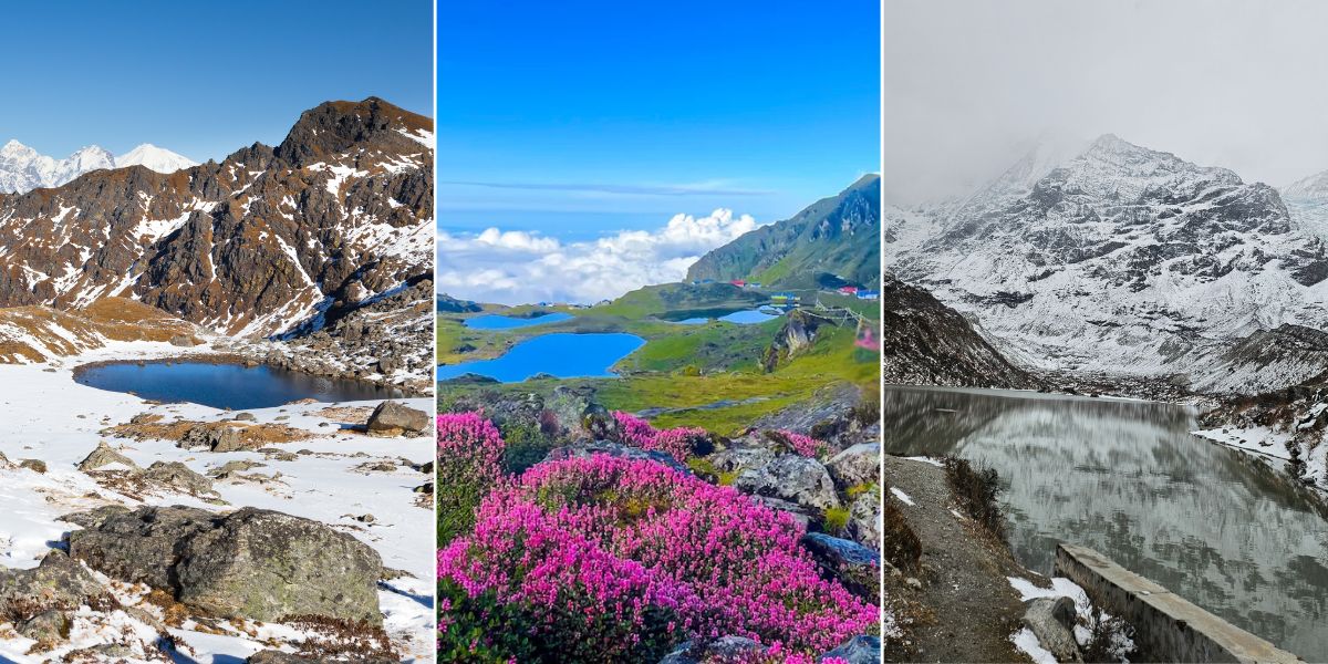
On the lake side, here are the most well-known lakes in Langtang National Park:
- Gosaikunda (or Gosain Kunda): This is the name everyone recognizes! Sitting at around 4,380 m, Gosaikunda is the most sacred of a cluster of glacial lakes, with local counts putting the total number in the wider Gosaikunda system at 108! Others include Bhairav Kunda, Saraswati Kunda, Dudh Kunda, Ama Kunda, Ragat Kunda, Nilkantha Kunda, Surya Kunda, etc.
- Panch Pokhari: Its literal meaning is "five ponds," which is another sacred lake cluster further east, and it anchors its own dedicated trek. The five ponds/lakes are Surya Kunda, Bhairav Kunda, Saraswati Kunda, Ganesh Kunda, and Naag Kunda.
- Lirung Glacial Lake: Unlike Gosaikunda or Panch Pokhari, this one is not a single pilgrimage lake but a proglacial and supraglacial pond system sitting right at the debris-covered snout of the Lirung Glacier, below Langtang Lirung.
When visiting these high-altitude lakes, kindly do not plan to swim ! I am saying this from experience, as I’ve witnessed heart-wrenching deaths of a few pilgrims who were only planning to bathe.
Note that these lakes sit at serious altitude, and several of them, especially Gosaikunda, are considered sacred by both Hindu and Buddhist communities. So, treat them with the same respect you would show a temple.
And if you really plan to take a dip in the holy waters, make sure you’re at a safe location (consult a local or a guide) and bear in mind not to spend too much time inside the waters!
Flora and Fauna of Langtang NP
Langtang National Park protects 1,043 recorded plant species, 21 of which are endemic to the region, along with 46 mammal species and 380 bird species.
I already covered how the vegetation changes across the park's five ecological zones earlier in this guide, so here I will focus on what you are actually likely to see and what is genuinely rare:
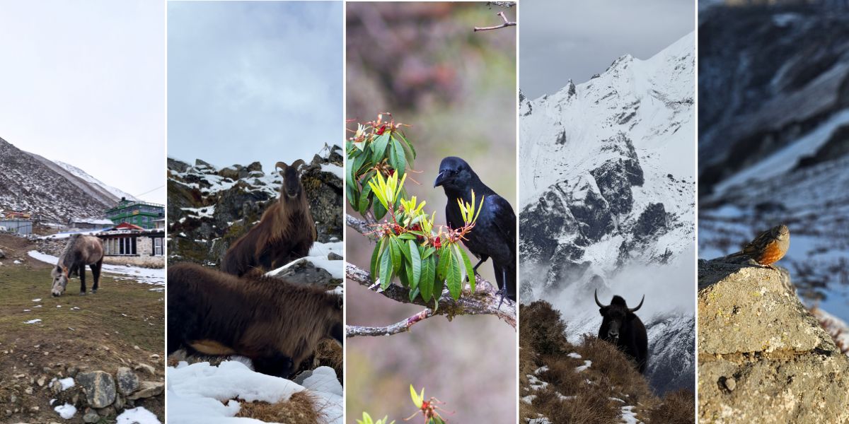
- Mammals:
- The red panda is the animal most people come here hoping to see. Langtang is one of the more reliable places in Nepal to spot one, particularly around Polangpati, Ghodatabela, Cholangpati, Magingoth, and Panch Pokhari in the subalpine zone.
- The snow leopard is present in the upper Langtang, Yangri, and Lendi valleys, but I will be honest with you: seeing one on a standard trek is extremely unlikely! They are elusive by nature, and their population across the Himalayas is difficult to estimate precisely.
- Other notable mammals include the Himalayan tahr, musk deer, Himalayan black bear, common and clouded leopard, grey wolf, serow, and the Assamese monkey and langurs at lower elevations.
- Birds: With 380 recorded species, Langtang is genuinely rewarding for birdwatchers. The Himalayan monal, Nepal's national bird, is a common sight in the temperate and subalpine zones, alongside the golden eagle, satyr tragopan, and the ibisbill, which you are more likely to spot along the rocky river valleys than in the forest.
- Livestock and working animals: Yak, nak (the female yak), chauri (a yak-cattle hybrid), horses, mules, sheep, and goats are all part of daily life in the upper valley, and you will share the trail with them constantly, particularly on the stretch above Langtang village.
- Conservation status: The red panda is listed as Endangered by the IUCN, and the snow leopard as Vulnerable. Both species face pressure from habitat fragmentation and climate-driven shifts in the treeline, on top of the more direct historical pressure of poaching. The park's ranger posts and buffer zone community programs are the main line of defense against this, and I will get into how that system works in the conservation section further down.
Everyday Life of Langtang People
The reason Langtang stays with people long after the trek ends is rarely the mountains alone. It is the villages you pass through, the families who host you in their teahouses, and the fact that the culture here has not been packaged for tourism the way it has in busier parts of Nepal!
Main Settlements and Villages
Dhunche is the park headquarters and the administrative gateway most trekkers pass through if approaching from Kathmandu, though the road up to here and beyond is currently under construction after the devastating flood and mudslide of 26th August, 2026.
Syaphru Bensi, at 1,467 m, is the traditional starting point of the Langtang Valley Trek but is no longer accessible, though it is one of the most important destinations to know about.
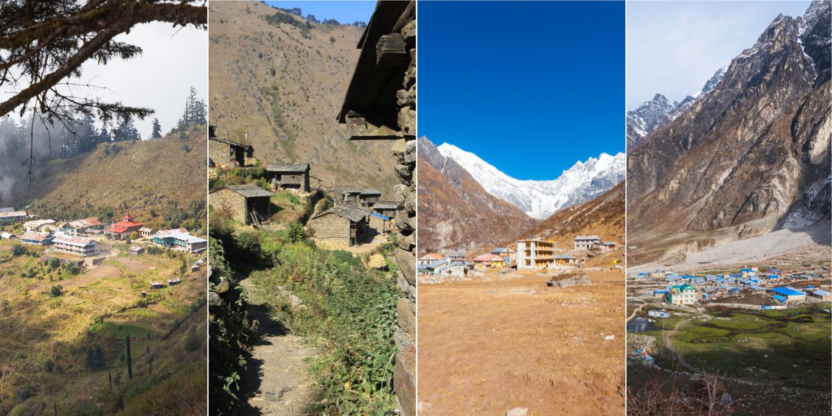
Moving up the valley, you pass through Bamboo, Lama Hotel, and Ghoda Tabela before reaching Langtang Village itself, the settlement that was almost entirely destroyed by the landslide triggered by the 2015 Gorkha earthquake and has since been rebuilt with earthquake-resilient construction about 1 km from the original spot.
Kyanjin Gompa, at around 3,890 m, is the final major village on the standard route and the base for side trips to Tsergo Ri, Kyanjin Ri, and Langshisha Kharka as well as high-altitude passes of Ganja La and Tilman. It is also home to a monastery and a small cheese factory that has been producing yak cheese for decades!
On the Gosaikunda side, Sing Gompa, also called Chandanbari, is a quiet monastery settlement with its own cheese factory, followed by Lauribina, a ridge-top cluster of lodges near the lake itself.
Past Gosaikunda on the descent toward Helambu, you will pass through Ghopte, Tharepati, and Kutumsang before reaching the larger Hyolmo villages of Tarkeghyang and Sermathang, both known for their monasteries and traditional architecture.
In the Panch Pokhari-Thangkpal area, the main village is Bhotang, home to the starting point of Chhimti. Likewise, Dipu Gaun remains the prominent village in the Jugal Himal Base Camp trail.
Main Ethnic Groups
The ethnic group that makes up most of the population inside the park is Tamang. You will also find Hyolmo in Panch Pokhari and Helambu regions.
And in smaller numbers, there are various ethnic communities: Newar, Kshetri, Hill Brahmin, Sherpa, Gurung, etc.
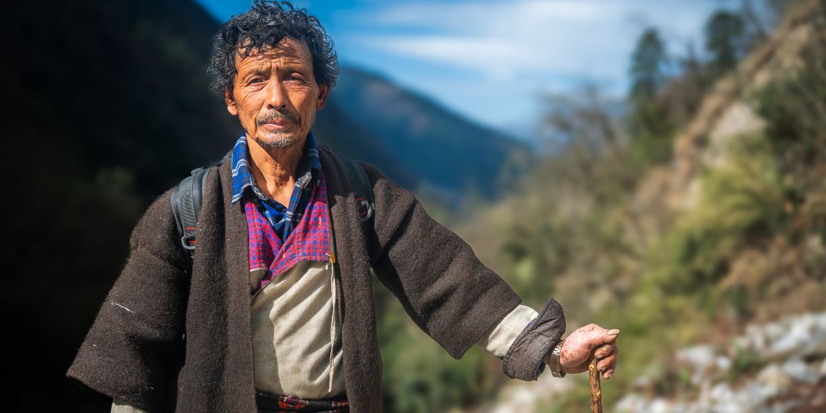
Since Tamang are the majority group across the Langtang region, let’s talk about them first. Their ancestors are believed to have Tibetan roots, and most of them practice a form of Tibetan Buddhism.
However, do not confuse the Tamang of Langtang with the more Tibetan-influenced Tamang communities living closer to the northern border, who locals sometimes distinguish as having stronger and more recent Tibetan connections, though both groups share the same Tibeto-Burman origins.
The Hyolmo, also written Yolmo, are concentrated mainly in the Helambu region to the east, in villages between roughly 2,000 m and 3,500 m. The Hyolmo are recognized as one of Nepal's 59 officially designated indigenous groups, and their total population is estimated at around 10,000 to 11,000 people.
Their language and culture are distinct from the Sherpa people of Solukhumbu, even though they are sometimes informally called "Sherpa" by outsiders, which is a genuine misconception worth correcting!
A Peek Into Their Daily Lifestyle
Life inside Langtang National Park still runs on agriculture, livestock, and, increasingly, tourism.
In the lower and mid-hill villages, families farm terraced plots of barley, potato, and buckwheat and keep goats, cows, and chickens. Higher up, past Langtang village, farming gives way almost entirely to yak and nak herding, since the growing season is too short and the altitude too extreme for most crops.
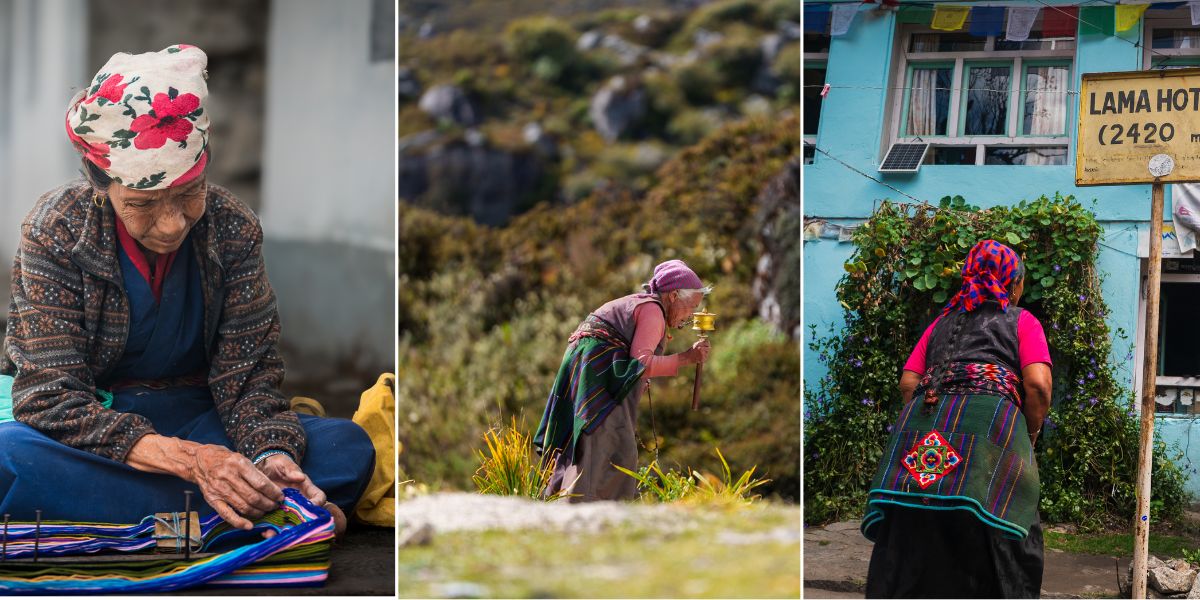
Trekking tourism has become the primary income source for many families along the main routes, particularly since the region reopened after the 2015 earthquake. Teahouses are usually family-run, and it is common for the same household to manage the lodge, the kitchen, and a small shop selling snacks and gear.
I suggest spending a little extra time in the evenings talking with your hosts if the language allows. Most of what I know about how the earthquake rebuild actually happened, I learned sitting by a fireplace in a Langtang teahouse!
Buddhism shapes daily rhythm more than almost anything else here. You will pass mani walls, chortens, and prayer flags constantly, and local custom asks that you pass them on your left, keeping them on your right shoulder, in the clockwise direction that Tibetan Buddhist practice follows.
Elders in most villages still spin prayer wheels daily, and butter lamps are lit in home shrines and monasteries as a regular part of life, not just during festivals!
Major Temples and Monasteries
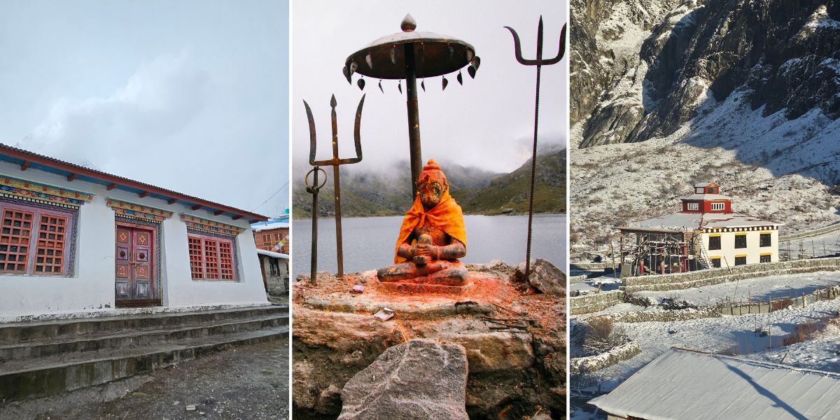
Here’s a list of the major temples and monasteries in Langtang National Park:
- Kyanjin Gompa: This is probably the most visited monastery in the park, sitting at the heart of the upper Langtang Valley and serving both as a place of worship and as the community's connection point for pilgrims and trekkers alike.
- Gosaikunda Temple: The Gosaikunda Lake itself functions as an open-air pilgrimage site rather than a built temple, and it is one of the most important Hindu pilgrimage destinations in Nepal, sacred to Lord Shiva. According to local Hindu tradition, Shiva created the lake by striking his trident into a glacier after swallowing poison during the churning of the cosmic ocean, and the lake's waters are believed to have healing properties tied to that story.
- Panch Pokhari Shiva Temple: Many trekkers heading to Panch Pokhari enjoy the Jugal Himal views along with the cluster of five ponds but sadly miss out on this hidden gem. Surrounded by prayer flags on all sides, the temple dedicated to Lord Shiva holds great religious importance to the Hindu community.
- Sing Gompa: En route to Gosaikunda, there’s this smaller monastery that holds similar significance to Kyanjin Gompa for the Tamang communities living around Chandanbari.
- Tarkeghyang Monastery: Located in Helambu, this is considered one of the more architecturally significant Hyolmo gompas in the region. Similarly, Sermathang's monastery and traditional houses are often cited as some of the best-preserved examples of Hyolmo village architecture left in Nepal.
- Ama Yangri Zangdopelri: At the summit of Ama Yangri Peak (3,771 m) in Helambu sits a small gompa called Ama Yangri Zangdopelri, named after Zangdopelri, Guru Padmasambhava's celestial "copper-colored mountain" pure land in Tibetan Buddhist belief. The Hyolmo community reveres Ama Yangri herself as a guardian deity, a protector figure watching over the Helambu valley, and pilgrims circle the gompa's prayer wheels and leave stone offerings here.
- Palchoki Mai Temple: On the Helambu side of the park's cultural sphere, traces its founding by local tradition to roughly the 5th century CE, making it one of the oldest recorded worship sites in the Sindhupalchok district.
Major Festivals
Now, here are the main festivals celebrated by the people of the Langtang region:
- Janai Purnima: Celebrated on the full moon day of Shrawan (typically August), this is the single biggest festival event inside the park. Thousands of Hindu pilgrims climb to Gosaikunda at 4,380 m to bathe in the sacred waters. Men even have Brahmin priests tie a new janai, a sacred thread, around their wrists. Shamans, or jhankris, gather at the lake in traditional dress to perform tantric dances and rituals, which makes this one of the most visually striking festivals you can witness anywhere in Nepal. If you are planning to trek during this window, book early. Teahouses around Gosaikunda fill up fast!
- Lhosar: The Tibetan and Tamang New Year is celebrated across the Tamang and Hyolmo villages of the park, usually in February, with feasting, dancing, and family gatherings. The exact date and the style of celebration can vary slightly between communities. Tamangs celebrate Sonam Lhosar, while Sherpa and Hyolmo celebrate Gyalbo Lhosar, and they fall on different days depending on the lunar calendar each community follows. Note that people in Langtang Valley celebrate Gyalbo Losar despite being Tamangs, considering their direct Tibetan roots.
- Dashain and Tihar: Nepal's two biggest national festivals are also observed across the park's Hindu and mixed-faith communities in September and October. However, the way they are celebrated in Tamang and Hyolmo villages carries a distinctly Buddhist flavor compared to how you would see them celebrated in Kathmandu.
- Other Himalayan festivals are also celebrated in the upper region, like Dhukpa Chheju, Saga Dawa, Nyungne, Langshisha Mela, etc.
Trekking Routes in Langtang National Park
Langtang National Park offers a genuinely wide spread of trekking options, from a short 5-day taste of the region to a 2 to 3 week combination trek that covers most of the park.
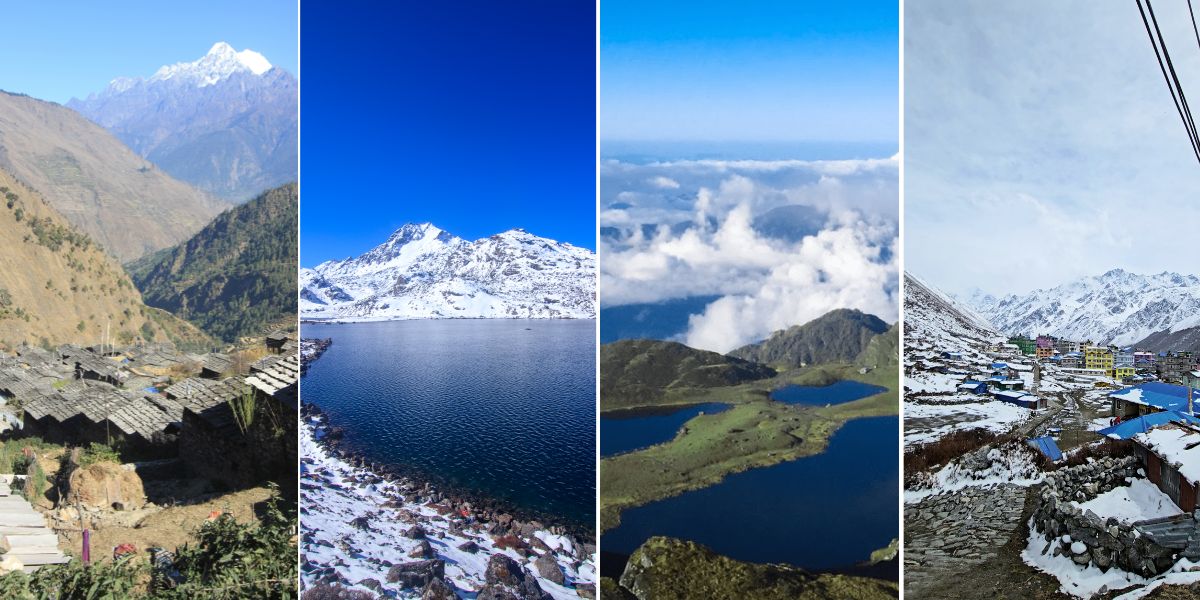
Here is how our team at langtangvalley.com has broken down the main options:
- Langtang Valley Trek (7 to 10 days): The classic route, and the one most first-time visitors choose. You start from Syaphru Bensi and follow the Langtang Khola up through Lama Hotel and Langtang village and finish at Kyanjin Gompa with side trips to Kyanjin Ri (4,700 m) and Tsergo Ri (4,984 m) for close-up mountain views. The trail is graded moderate, suitable for reasonably fit beginners with proper acclimatization.
- Gosaikunda Trek (5 to 8 days): A shorter route focused on reaching the sacred lakes, typically starting from Dhunche and climbing through Sing Gompa and Lauribina to Gosaikunda at 4,380 m. This is the trek most tied to Janai Purnima pilgrimage traffic in August. You can even pick a longer route via Sundarijal or a new alternative route via Dupcheshwor Mahadev Temple.
- Langtang - Gosaikunda Trek (11 to 14 days): This is the combination of the first two routes above. You do the full Langtang Valley section first, cross back down, then climb over to Gosaikunda via Cholangpati (return possible via Dhunche or Sundarijal). It gives you glaciers, high peaks, and the sacred lakes in one trip!
- Panch Pokhari Trek (5 to 12 days): The new route now starts from Chhimti, leaving the old longer route from Chautara. You move toward the Panch Pokhari lake cluster at the foot of the Jugal Himal range, well away from the main Langtang crowds. Facilities are thinner here than on the Langtang or Gosaikunda trails, so I would treat this as a trek for people who already have a Himalaya trek or two behind them.
- Tamang Heritage Trail with Langtang Valley (11 to 14 days): This route stays lower and focuses on cultural immersion in Tamang villages like Gatlang, Tatopani, and Briddhim, with hot springs and traditional homestays along the way. It is a strong choice if you want an extended cultural experience from the main Langtang Valley trail. While our versions of the Tamang Heritage Trail usually cover both sections, you may even opt for the Classic Tamang Heritage approach that includes only the lower regions (up to Birddhim).
- Helambu Circuit (8 to 10 days): A lower-altitude trek through Hyolmo villages, including Tarkeghyang and Sermathang, ideal if you want strong culture and forest scenery without pushing much above 3,600 m. Also, you can reach Ama Yangri, the highest point of the trek (but it remains optional). In fact, a standalone Ama Yangri Trek is also possible for those only seeking a short adventure.
- Extended Langtang Trek (13 to 16 days): Honestly, this is the most complete way to see the park! You start from the Tamang villages, link with Langtang Valley, cross to Gosaikunda, then descend through the Helambu region via the Lauribina Pass at 4,610 m, finishing near Kathmandu. This is a serious undertaking in terms of both distance and altitude gain, and I would only recommend it to trekkers with prior high-altitude experience or a generous acclimatization schedule.
- Jugal Himal Base Camp Trek (8 to 12 days): The least-trekked option in the park, reaching the Panch Pokhari lake cluster first, followed by the base of the Jugal Himal peaks. The trail here is rougher, and infrastructure is thinner, so I would not recommend this if it’s your first Himalaya trek.
- Ganja La Pass (12 to 14 days): This is the traditional high pass connecting Langtang Valley to Helambu, crossed as part of extended combination treks and requiring proper snow and glacier travel skills. It sees far less traffic than Lauribina La, so you will want an experienced guide and good weather, since the route is exposed and route-finding gets tricky in poor visibility.
- Tilman Pass (15 to 17 days): Named after explorer H.W. Tilman, this remote pass links the Langtang region to Panch Pokhari, and it is one of the more technical, rarely crossed passes in the park. It demands genuine mountaineering competence and full glacier travel gear, so I would only suggest it to experienced trekkers with a specialized guide, not as a standard extension to a normal itinerary.
- Beyond Langtang National Park: A few nearby treks are worth knowing about if you want to extend your trip or build a longer itinerary: the Ruby Valley Trek and Ganesh Himal Trek, both just west of Langtang in Dhading, and the Bhairab Kunda Trek in the Gaurishankar Conservation Area to the east, which also doubles as an alternate route into the Jugal Himal Base Camp Trek.
- Langtang Valley and Gosaikunda Helicopter Tour (approx. 4 days): For travelers short on time or unable to handle too many days of walking, a helicopter tour covers both Kyanjin Gompa and Gosaikunda in just a few days. It is by far the most expensive way to see the park, but it is also the fastest, and it has become a more visible option since parts of the standard road and trail network took damage in the 2026 flood.
Important note on the 2026 access disruption: Because the Bhotekoshi flood damaged the Rasuwagadhi, Syaphru Bensi, and Mailung entry points, some itineraries have been adjusted to start from alternate access points. For eg, we now do the Langtang Valley Trek from Sundarijal as well as from Dhunche.
Peak Climbing and Expeditions
Langtang is not only about trekking trails and wildlife. The region also holds a genuine spread of peak climbing and expedition options, all the way from beginner-friendly trekking peaks to serious 7,000 m expeditions.
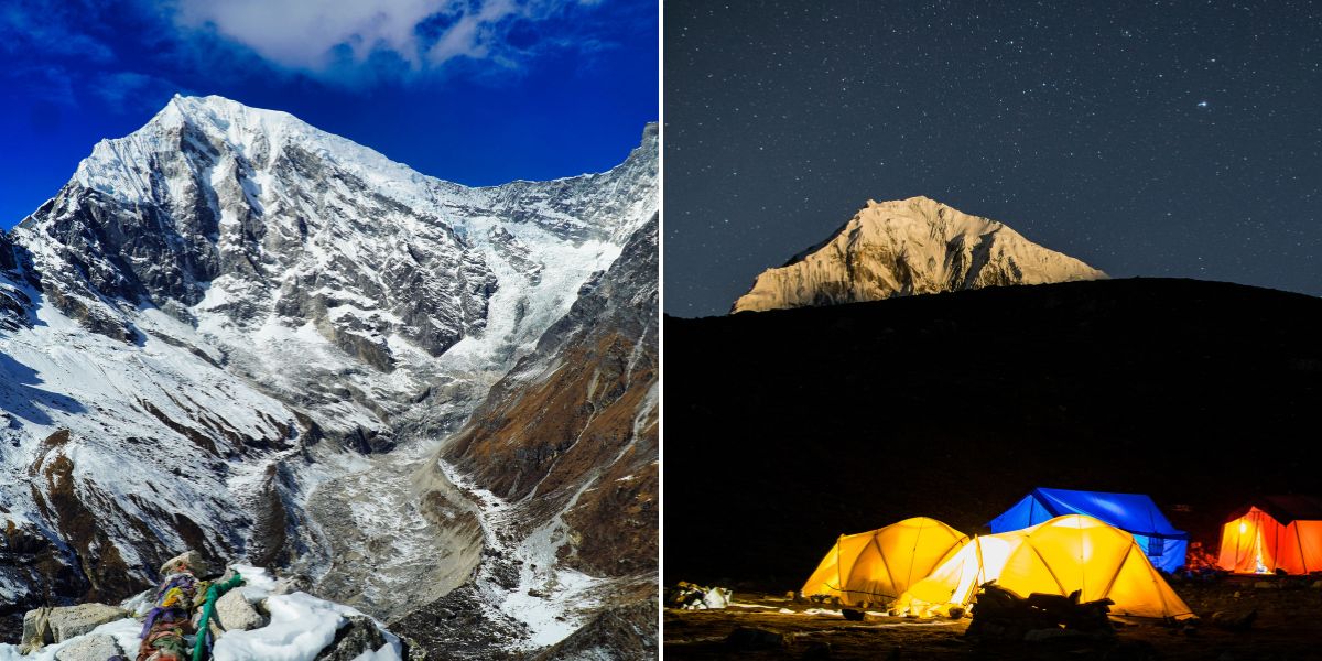
Nepal splits authority over these mountains between two bodies. The Nepal Mountaineering Association (NMA) regulates a small, defined set of peaks, while the Department of Tourism (DoT) handles everything else, including the highest and the most remote summits:
- Over 7,000 m (Expedition peaks): Langtang Ri (7,205 m) and Langtang Lirung (7,234 m) are the only two peaks in this bracket, both in the Langtang Himal. These are full expeditions under the Department of Tourism, requiring a liaison officer and the full expedition logistics that come with any 7,000 m Himalayan climb.
- NMA Group A (technical trekking peaks): Yubra Himal (6,048 m) in the Langtang Himal and Langshisha Ri (6,412 m) in the Jugal Himal fall here. Both demand real technical comfort, since routes involve mixed climbing and steep ice sections rather than a straightforward glacier walk.
- NMA Group B (non-technical trekking peaks): Naya Khanga, also called Ghanja La Chuli (5,863 m), and Yala Peak (5,732 m) are the two main options here, and this is where most first-time peak climbers in Langtang start. Yala in particular (Yala South being a more popular option among beginners) is treated as a royalty-free peak, making it the most accessible summit in the entire region.
- Non-NMA peaks, 6,500 to 6,999 m: The Department of Tourism handles a longer list here, including Pem Thang Karpo Ri, Salbachum, Pangri Goldumba, Kyunga Ri I and II, Dhagpache, and Ghenye Liru in the Langtang Himal, and Loenpo Gang, Dorje Lhakpa, Gurkarpo Ri, Bhairab Takura, Loenpo Gang East, Phurbi Chyachu, and Yangri in the Jugal Himal.
- Non-NMA peaks, below 6,500 m: Also under the Department of Tourism, this bracket includes Thakmorpa Ri, Peri, Bhemdang Ri, and Thakmorpa North East on the Langtang side, and Ganchenpo, Gyalzen Peak, Urkenmang, and Baden Powell Scout Peak on the Jugal side.
Langtang National Park Permits and Costs
Permits in Langtang follow Nepal's usual layered system, where different authorities issue permits for different protected areas and activities. Here is the short version.
Trekking Permits
Every trekker needs the Langtang National Park Entry Permit (LNPEP), priced at NPR 3,000 for foreigners, NPR 1,500 for SAARC nationals, and NPR 100 for Nepalese citizens.
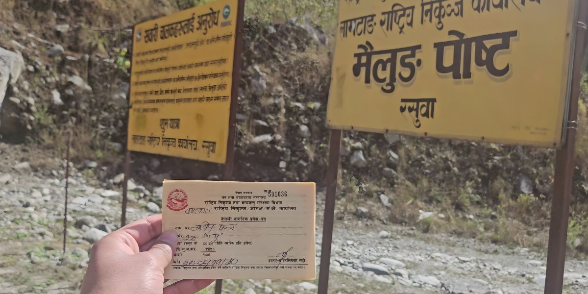
Depending on your exact route, you may also need one or more additional permits:
- Routes that pass through Sundarijal, like some Gosaikunda, Helambu Circuit, or extended Langtang itineraries, require the Shivapuri-Nagarjun National Park Entry Permit as well.
- The Tamang Heritage Trek requires a Restricted Area Permit for Thuman, since it falls within Gosaikunda Ward 1, a genuinely restricted zone where FITs are barred and a licensed guide is mandatory.
- And if your route to Jugal Himal Base Camp goes via Bagam-Bhairabkunda instead of Panch Pokhari, you will need a Gaurishankar Conservation Area Permit too.
Each of these exists because you are technically crossing into a separate protected area with its own management authority, so the fees stack rather than replace one another!
Peak Climbing and Expedition Permits
Costs here depend entirely on which category your peak falls under:
- Royalty-free peaks like Yala Peak still carry a mandatory USD 500 garbage management deposit, refundable once you bring your waste back to the LPCC site and get it certified.
- NMA Group A and B peaks, such as Yubra Himal, Langshisha Ri, and Ganja La Chuli, carry seasonal royalty fees from USD 175 to 350 for foreigners, plus the same garbage deposit.
- Full expeditions above 7,000 m, meaning Langtang Ri and Langtang Lirung, run considerably higher, from USD 200 to 800 depending on the season, on top of the garbage deposit and a required liaison officer.
Additional Permits
If your trip involves anything beyond standard trekking or climbing, budget extra time and paperwork:
- Professional filming requires clearance from MoCIT starting at USD 1,500 for foreign production companies, plus a consent letter from DNPWC.
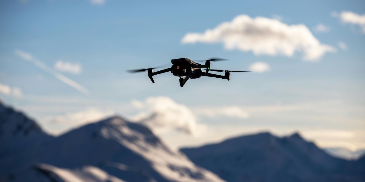
- Drone filming is its own process entirely, involving CAAN, the Ministry of Home Affairs, and the Ministry of Defence, since much of this region sits along a sensitive international border, and the full approval can take more than a month.
If any part of this applies to you, start the paperwork early, ideally three months out if you are a foreign national.
And if you want the full breakdown, including route-by-route requirements and every fee table, we have covered that in a dedicated Langtang permits guide here.
Best Time to Visit Langtang NP
The two strongest windows for trekking in Langtang National Park are spring and autumn, and I would steer most first-time trekkers toward one of these two seasons:
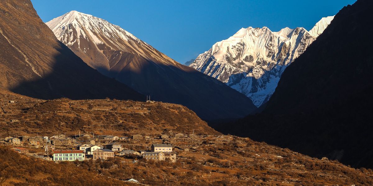
- Spring (March to mid-June) brings rhododendron blooms through the temperate zone, generally stable weather, and clear mountain views, particularly in April and May before the pre-monsoon haze builds up. This is also a good window if you want to attempt Yala Peak or Naya Khanga, since snow conditions tend to be more predictable.
- Autumn (late September to mid-December) is, in my experience, the single most reliable window for mountain visibility, since the monsoon has just cleared the air and skies stay sharp well into November. October and early November are the busiest months on the main Langtang Valley trail, so expect more company at teahouses!
Now, what about the other times? I won’t say they are bad, but requires comparatively more caution.
Monsoon (late June to mid-September) brings heavy rain, leech-heavy lower trails, and a real risk of landslides on the access roads, particularly given the damage the 2026 flood caused to the Rasuwa road network.
Honestly, I do not recommend trekking here during peak monsoon unless your specific goal is the Janai Purnima festival at Gosaikunda, Panch Pokhari, or Parvati Kunda (part of Tamang Heritage Trail) in August, which draws pilgrims regardless of the rain.
On the other hand, winter (late December to February) is workable for the lower routes like the Tamang Heritage Trail or Helambu Circuit, but the higher sections toward Kyanjin Gompa and Gosaikunda see heavy snow, and some teahouses close entirely.
If you do go in winter, confirm with a reliable agency (like us) that your planned teahouses are actually open before you commit to the itinerary!
Conservation and Environmental Challenges
Langtang's biggest conservation story right now is the same one facing the entire Himalaya: retreating glaciers and a shifting climate.
The park has lost an estimated 41% of its Little Ice Age glacier extent, and that retreat directly threatens the water systems that villages, farmland, and wildlife all depend on downstream.
The park's buffer zone system is the primary tool for balancing conservation with the needs of the roughly 21 wards of people living in and around the protected area.
Between 30 and 50% of park revenue, generated mainly through entry permits, is channeled back into local communities for conservation education, skill-building programs, and community development.
In exchange, buffer zone residents are permitted regulated access to firewood collection and livestock grazing, activities that are restricted inside the core park area for others.
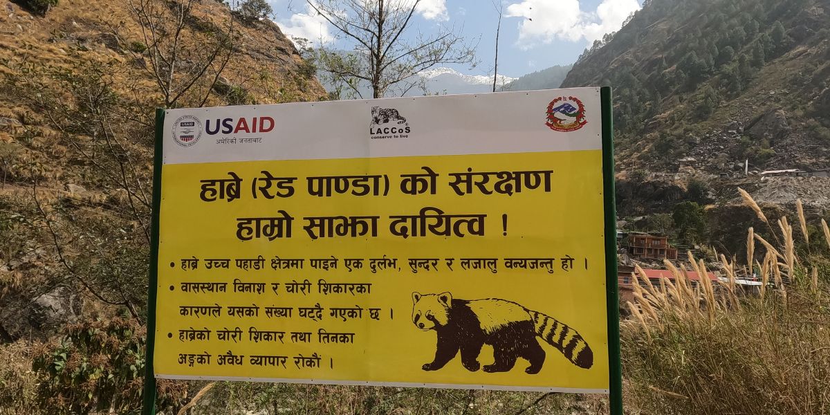
Poaching and wildlife trafficking remain real threats, particularly for red pandas and musk deer, both valued on illegal wildlife markets. Ranger posts across the park, several of them rebuilt or expanded since the 2015 earthquake destroyed 15 security posts in this region, continue conservation patrols and community-based monitoring programs.
The most immediate and recent challenge is the August 2026 Bhotekoshi flood. A glacial or landslide-dammed river burst near the Nepal-Tibet border on 26 August 2026, sending a catastrophic flood down the Bhotekoshi and Trishuli river systems.
The disaster killed thousands of people, destroyed the Rasuwagadhi customs complex along with the Miteri Bridge, and severely damaged the Trishuli Corridor connecting to the Tibet border (even affecting Kailash and Lake Mansarovar pilgrims), along with several hydropower projects in Rasuwa and Nuwakot districts.
This has directly affected access to the Kerung border route and parts of the Langtang trekking approach, and recovery is still ongoing!
Tourism itself is both a pressure and a solution here. More visitors mean more waste, more demand on limited infrastructure, and more strain on fragile alpine ecosystems above the treeline.
However, tourism revenue is also what funds the conservation programs protecting this exact landscape.
Keeping all these things in mind, I suggest trekking with agencies (like Altitude Himalaya) who commit to proper waste management and who employ local guides and porters, since that is genuinely one of the more direct ways a visitor can support conservation here rather than undermine it!
Travel Guide for Visiting Langtang National Park
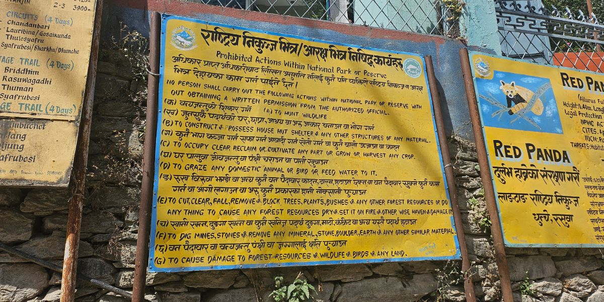
Now, let me offer some tips to all readers planning a trip to Langtang National Park in the coming months:
- Getting there: Most trekkers reach Langtang National Park by road from Kathmandu, either by public bus or private vehicle, taking 5 to 7 hours to reach Syaphru Bensi or Dhunche depending on road conditions. Helicopter tours and charters are also increasingly popular for those short on time or looking to skip the long drive, and they have become a more visible option since parts of the standard road network were damaged in the 2026 flood.
- Where to stay: Accommodation follows the standard Nepal teahouse model along the main routes, with basic but comfortable family-run lodges offering simple rooms and hearty meals, mostly dal bhat, noodle soups, and basic western options. Homestays are common on the Tamang Heritage Trail and in the Helambu region. For more remote routes such as Panch Pokhari or Jugal Himal Base Camp, where teahouse infrastructure is limited, camping is an option.
- Health and safety: Rasuwa Hospital in Dhunche provides basic care, and some of the larger villages in Helambu have health posts, but facilities throughout the park are truly limited. I would highly recommend to bring a proper trekking medical kit and have travel insurance that covers high-altitude trekking and helicopter evacuation, not just insurance. Altitude sickness is a real risk on any route that climbs over 3,500 m, including the standard Langtang Valley and Gosaikunda treks. Ensure you have proper acclimatisation days rather than rushing the itinerary.
- What to pack: Layered clothing is essential given how much the climate shifts across the park's five ecological zones, from subtropical valley floor to true alpine terrain above 4,000 m. A good sleeping bag rated for at least -10°C (particularly during winters and on high pass treks), solid waterproof layers, and proper trekking boots are non-negotiable if you are going above Kyanjin Gompa. Read our Langtang packing guide for more info.
- Responsible travel: Respect mani walls and chortens by passing them on your left. Ask before photographing people, especially inside monasteries. Support local teahouses and guides rather than pre-packaged group tours that bypass the community economy entirely. And if you are trekking during a festival like Janai Purnima, remember you are a guest at a religious event (not just a spectator, so help out if you can).
- Access update: As recovery from the August 2026 flood is still underway, I suggest checking your specific route and starting point with your agency or the Nepal Tourism Board before finalising your itinerary!
Final Thoughts
Langtang National Park has given me one of the clearest lessons I have learned about trekking in Nepal: closeness to Kathmandu does not mean less reward. This protected area holds real glaciers, real high peaks, genuinely rare wildlife, and a culture that has stayed remarkably intact despite sitting less than a day's drive from the capital!
It has also been through real hardship, from the 2015 earthquake that erased Langtang village almost entirely to the 2026 flood that is still reshaping how people access this region.
Yet, how consistently the local communities rebuild and keep hosting trekkers with the same warmth, even after losing so much, is truly wonderful! And that resilience is worth witnessing in person, not just reading about.
So, if Langtang is going to be your first Himalayan trek, pat yourself on the back! And even if it is your fifth or tenth, I think you will still find something here that other busier routes have lost.


 Bhishu Acharya