By now, we are all aware of the devastating flash flood that shook Nepal on the morning of 26th August 2026 (Wednesday).
The disaster unfolded with a glacier collapse occurring on one of the Langtang mountains, Langtang Lirung, near the Nepal-Tibet border, prompting a series of chain events starting from the blockage of Lhende Khola (aka Lende River, or Donglin Tsangpo on the Tibetan side), a branch that joins the Bhote Koshi River at the border of Rasuwagadhi.
Thereafter, the blockage failed, releasing a massive amount of water, mud, ice, and rock down the Bhote Koshi chasm.
After travelling down the gorges and riverway at such an incredible speed, the flood made contact with Rasuwagadhi at the Nepal-China border at approximately 9 AM, leaving no trace of a border post before roaring down into the Trishuli River to claim more lives and infrastructure along the way.
The flood had traveled from the Bhote Koshi-Trishuli River corridor, passing through Rasuwa, Nuwakot, and Dhading, even extending to Gorkha, Tanahun, Chitwan, and Nawalparasi districts.
This wasn’t a normal natural calamity; it was one of the biggest floods that Nepal had ever seen, with devastating results, leaving many people homeless and stranded. Many lives were lost, and the count is still going up.
With so much destruction, it's still incredibly difficult to say how long it will take for things to go back to normal!
The topic of our article also happens to be affected heavily by this flood. Also, the gateway to the Langtang region, i.e., Syabrubesi, was demolished in this incident, and it's hard to tell when it’s going to recover.
The standard itinerary for the Langtang Valley Trek most of the time used to begin from here. So, now that it’s not accessible, you might be wondering: now what?
How can you use those routes or trails to do the trek this year, since many of you have already booked or are planning to do it but are puzzled by the current situation?
No worries, we have your back! Just go through this blog, and you will have a clearer picture by the end of it.
A Quick Look into Routes For Langtang Valley
|
Route
|
Status
|
Starting Point
|
Approx. Days
|
Difficulty
|
Best for
|
|
Syabrubesi - Domen - Langtang Valley
(Standard Route)
|
Inaccessible
|
Syabrubesi
|
5-8 days
|
Easy to Moderate
|
Beginners
|
|
Dhunche - Thulo Syabru - Langtang Valley
|
Soon to be Accessible
|
Dhunche
|
7 days
|
Moderate
|
Beginners
|
|
Sundarijal - Gosaikunda - Cholangpati - Thulo Syaphru - Langtang Valley
|
Accessible
|
Sundarijal
|
10 days
|
Moderate to Difficult
|
Intermediate
|
|
Panchpokhari - Tilman Pass - Langtang Valley
|
Accessible
|
Chhimti
|
12-14 days
|
Streneous
|
Experienced
|
|
Dupcheswor - Talu Phedi - Gosainkunda - Langtang Valley
|
Accessible
|
Talu Phedi
|
8-10 days
|
Moderate
|
Intermediate
|
What Happened to Langtang Valley Trek After the 2026 Flood?
After the destruction caused by the massive flood, foreign aid from India, China, the European Union, UNICEF, Japan, WHO (World Health Organization), UAE, United Kingdom, etc., which included humanitarian supplies, medical kits, large water purification tanks, tents, blankets, and grants amounting to millions, flew in to help Nepal:
- India: Tunnel-reconnaissance experts and forensic/DNA analysis scientists
- China: DNA identification experts along with tunnel fire and rescue experts
- South Korea: tunnel rescue experts and drone pilots
- United States: military aviation logistics specialists
- Malaysia: 11-Member Elite SMART Team & Drones
- Australia: Disaster response specialists and crisis management teams
- United Kingdom: humanitarian advisers, logistics specialists, engineers, and data experts
- Japan: Disaster relief expert team
The main highway, being the Trishuli Corridor (Galchhi-Mailung-Syabrubesi-Rasuwagadhi), was destroyed. The whole 72 km stretch from Battar up to the Rasuwagadhi border was decimated, and Prithvi Highway, though not entirely damaged, had its critical chokepoint severely broken as the thundering Trishuli River caused a catastrophic road collapse at Krishnabhir and Parewa Bhir in Dhading.
Timure was among the worst-hit, closest to the border side. Syabrubesi, the gateway to the Langtang Valley Trek, was also decimated, as most of the place is in ruins. Ghatte Khola, which is just a short distance away from Rasuwagadhi, is also in ruins.
Mailung was reported to be 90% destroyed, while 300+ residents and construction workers trapped here have been evacuated. Likewise, Khalte and Betrawati were places that were mostly swept away.
Is Langtang Valley Still Accessible?
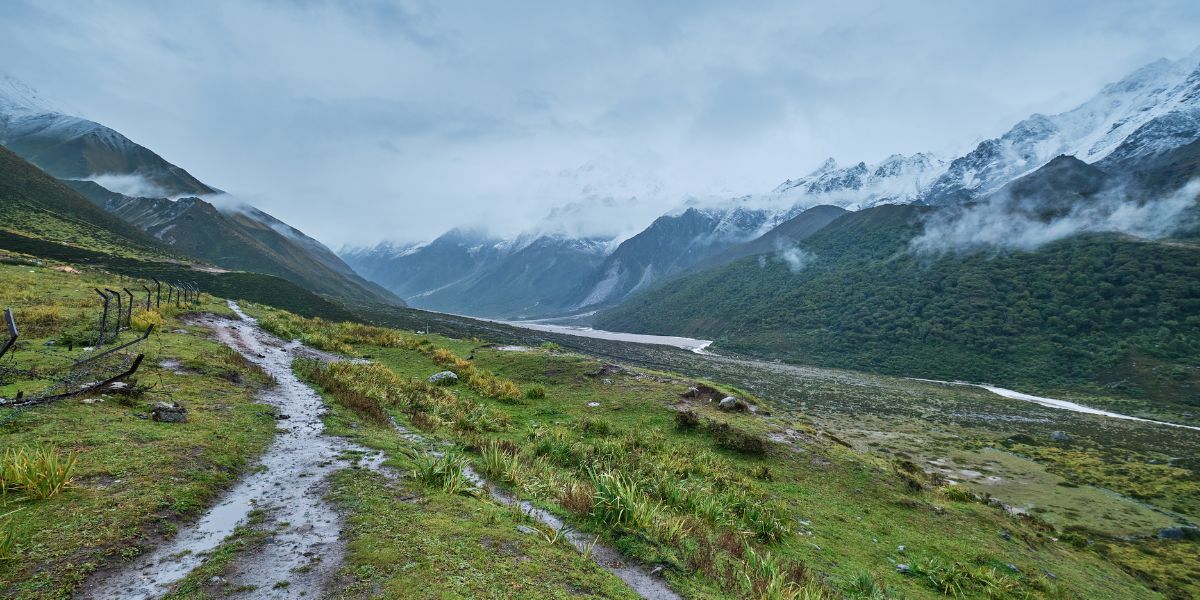
Fortunately, the flood didn’t affect the upper parts of this region, resulting in the trekking trail of Langtang Valley Trek being safe. However, the same cannot be said for the Tamang Heritage Trek.
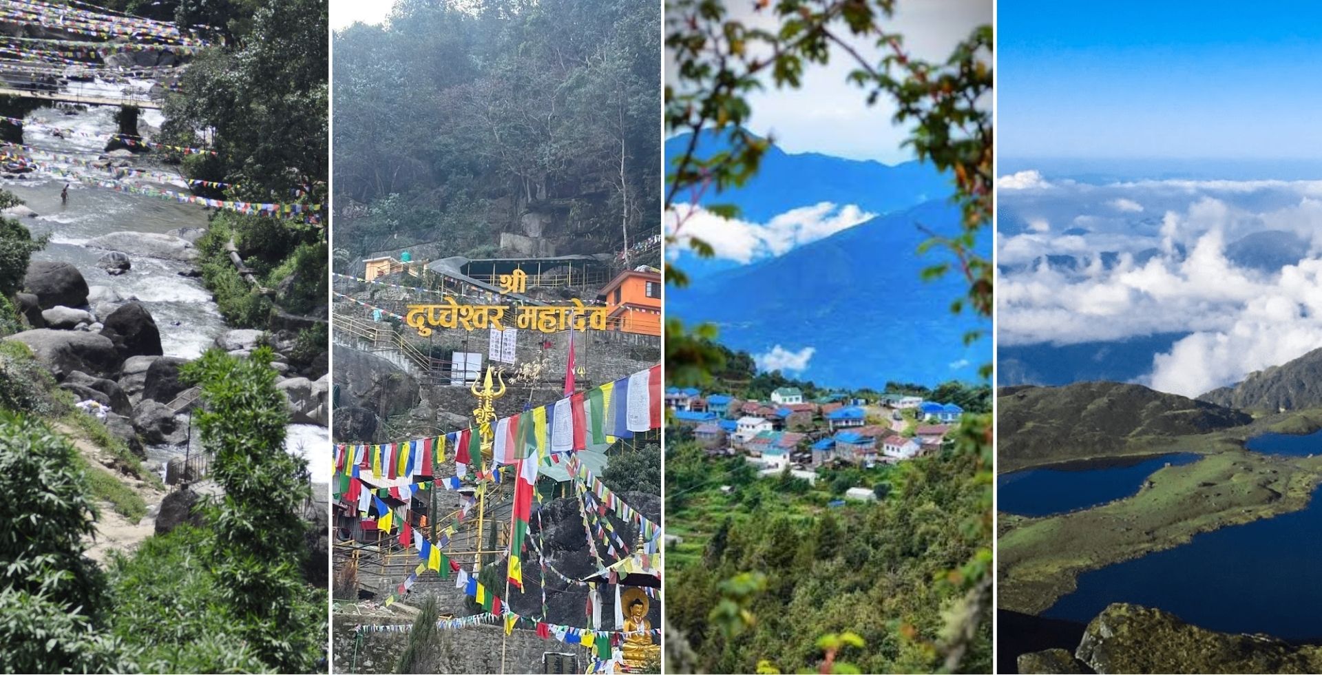
You can still take the alternative route from Dhunche, Dupcheswor, Sundarijal, or Tilman Pass via Panch Pokhari to reach the trail route for Langtang Valley and continue normally. Only the lower Syabrubesi area was damaged, which was right beside the river; the rest of the trail is just fine.
We have already drafted alternative routes for you to check out so as to make it easier for you to decide whether to undertake this trek or not. The routes are as follows:
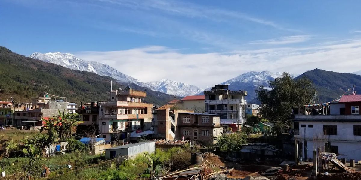
Route #1: Starting Dhunche
This itinerary is a safer alternative, as it completely avoids the town that was most severely destroyed by the flood, i.e., Syabrubesi.
This route starts from Dhunche/Bharkhu and weaves through Deurali rather than going through Syabrubesi, which is a logical move to make.
Outline Itinerary
Day 01: Kathmandu to Dhunche Drive, Trek to Deurali.
- Drive Route (depends on road condition):
- Thamel (or designated place in Kathmandu) > Tokha > Chahare > Chaughada Bridge > Aapra > Lachyang > Sarmathali > Patikharka > Kalikasthan > Ramche > Thade > Dhunche
- Thamel > Tokha > Chahare > Thansing > Suryamati > Bidur > Betrawati > Ramche > Dhunche
- Drive Distance: 95 - 110 km
- Drive Duration: 5 to 6 hours
- Trek Route: Dhunche > Sapche > Ghatte Khola > Khendi > Deurali
- Trek Distance: 5 km
- Trek Duration: 3 - 4 hrs
- Elevation Gain: 1,350 m
- Accommodation Type: Teahouse
Day 02: Deurali to Bamboo.
- Trek Route: Deurali > Dhimsa > Chandanbari > Dursagang > Thulo Syaphru > Pairo > Bamboo
- Trek Distance: 15 km
- Trek Duration: 7 to 8 hours
- Elevation Gain: 590 m
- Elevation Loss: 1,270 m
- Accommodation Type: Teahouse
Day 03: Bamboo to Thangshyap.
- Trek Route: Bamboo > Rimche > Lama Hotel > Gumnachok > Chhunama > Pering Kharka > Ghoda Tabela > Thangshyap
- Trek Distance: 11 km
- Trek Duration: 6 to 7 hours
- Elevation Gain: 1,160 m
- Accommodation Type: Teahouse
Day 04: Thangshyap to Kyanjin Gompa, Kyanjin Ri Sunset Hike.
- Trek Route: Thangshyap > Tsarting > Chyamki > Gumba > Langtang Village > Mundu > Sindhum > Kyanjin Gompa > Kyanjin Ri > Kyanjin Gompa
- Trek Distance: 15 km
- Trek Duration: 11 to 12 hours
- Elevation Gain: 1,160 m to 1,560 m
- Elevation Loss: 400 m to 800 m
- Accommodation Type: Lodge
Day 05: Tsergo Ri Morning Hike, Explore Kyanjin.
- Trek Route: Kyanjin Gompa > Tsergo Ri > Kyanjin Gompa
- Trek Distance: 10 km
- Trek Duration: 7 to 8 hours
- Elevation Gain: 1,110 m
- Elevation Loss: 1,110 m
- Accommodation Type: Lodge
Day 06: Kyanjin Gompa to Lama Hotel.
- Trek Route: Kyanjin Gompa > Langtang Village > Ghoda Tabela > Lama Hotel
- Trek Distance: 18 km
- Trek Duration: 5 to 6 hours
- Elevation Loss: 1,380 m
- Accommodation Type: Teahouse
Day 07: Lama Hotel to Sano Bharkhu, Drive to Kathmandu.
- Trek Route: Lama Hotel > Rimche > Bamboo > Pairo > Thulo Syaphru > Brabal > Sano Bharkhu
- Trek Distance: 16 km
- Trek Duration: 5 to 6 hours
- Drive Route (depends on road conditions):
- Sano Bharkhu > Thulo Bharkhu > Dhunche > Ramche > Sarmathali > Lachyang > Chahare > Tokha > Your hotel in Kathmandu
- Dhunche > Betrawati > Bidur > Chahare > Tokha > Your hotel in Kathmandu
- Drive Distance: 100 to 105 km
- Drive Duration: 5 to 6 hours
- Elevation Loss: 1,200 m
Note: You can also start the trek from Thulo Bharkhu or Sano Bharkhu, which are approx. 5 km and 6 km, respectively, from Dhunche.
Route #2: Longer Approach Via Gosaikunda
A short disclaimer: If you opt to go for this route, something to keep in mind is that you will be trekking through two national parks, so you will require two permits:
- Langtang National Park Entry Permit
- Shivapuri National Park Entry Permit
Outline Itinerary via Sundarijal
This, in particular, is the Gosainkunda Langtang Trek from Sundarijal:
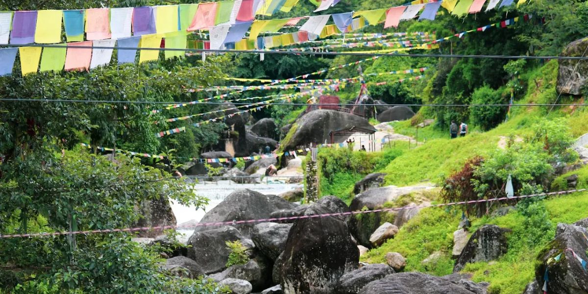
Day 01: Kathmandu to Sundarijal, Trek to Chisapani.
- Drive Route: Thamel (or designated place in Kathmandu) > Chabahil > Jorpati > Gokarna > Sundarijal Bus Park
- Drive Distance: 20 km
- Drive Duration: 1 hour
- Trek Route: Sundarijal > Mulkharka > Borlang Bhanjyang > Chisapani
- Trek Distance: 10 - 12 km
- Trek Duration: 4-5 hrs
- Elevation Gain: 850 m
- Accommodation Type: Lodge
Day 02: Chisapani to Kutumsang.
- Trek Route: Chisapani > Pati Bhanjyang > Thakani > Chipling > Jogini Danda > Gul Bhanjyang > Kutumsang
- Trek Distance: 18 km
- Trek Duration: 7 to 8 hours
- Elevation Gain: 300 m
- Accommodation Type: Teahouse
Day 03: Kutumsang to Gopte.
- Trek Route: Kutumsang > Kyuola Bhanjyang > Mangengoth > Thadepati Bhanjyang > Gopte
- Trek Distance: 14 km
- Trek Duration: 8 to 9 hours
- Elevation Gain/Loss: 1,220 m / 260 m
- Accommodation Type: Teahouse
Day 04: Gopte to Gosaikunda via Suryakunda/Laurebina Pass.
- Trek Route: Gopte > Phedi > Laurebina Pass/Surya Kunda > Gosaikunda
- Trek Distance: 11 km
- Trek Duration: 7 to 8 hours
- Elevation Gain/Loss: 1,170 m / 230 m
- Accommodation Type: Teahouse
Day 05: Gosaikunda to Thulo Syaphru.
- Trek Route: Gosaikunda > Laurebina > Cholangpati > Thulo Syaphru
- Trek Distance: 12 km
- Trek Duration: 6 to 7 hours
- Elevation Loss: 2,130 m
- Accommodation Type: Teahouse
Day 06: Thulo Syaphru to Ghoda Tabela.
- Trek Route: Thulo Syaphru > Pairo > Bamboo > Rimche > Lama Hotel > Chhunama > Pering Kharka > Ghoda Tabela
- Trek Distance: 16 km
- Trek Duration: 7 to 8 hours
- Accommodation Type: Teahouse
Day 07: Ghoda Tabela to Kyanjin Gompa.
- Trek Route: Ghoda Tabela > Thangshyap > Tsarting > Chyamki > Gumba > Langtang Village > Mundu > Sindhum > Kyanjin Gompa
- Trek Distance: 12 km
- Trek Duration: 7 to 8 hours
- Accommodation Type: Lodge
Day 08: Tsergo Ri or Kyanjin Ri Hike.
- Lower Kyanjin Ri:
- Total Distance: 3 km
- Total Duration: 2 hours
- Elevation Gain: 400 m
- Elevation Loss: 400 m
- Kyanjin Ri:
- Total Distance: 4 km
- Total Duration: 4-5 hours
- Elevation Gain: 800 m
- Elevation Loss: 800 m
- Tsergo Ri:
- Total Distance: 9 km
- Total Duration: 7 to 8 hours
- Elevation Gain: 1,100 m
- Elevation Loss: 1,100 m
Day 09: Return to Lama Hotel.
- Trek Route: Kyanjin Gompa > Langtang Village > Ghoda Tabela > Lama Hotel
- Trek Distance: 18 km
- Trek Duration: 5 to 6 hours
- Elevation Loss: 1,380 m
- Accommodation Type: Teahouse
Day 10: Lama Hotel to Sano Bharkhu, Drive to Kathmandu.
- Trek Route: Lama Hotel > Rimche > Bamboo > Pairo > Thulo Syaphru > Brabal > Sano Bharkhu
- Trek Distance: 16 km
- Trek Duration: 5 to 6 hours
- Drive Route (depends on road conditions):
- Sano Bharkhu > Thulo Bharkhu > Dhunche > Ramche > Sarmathali > Lachyang > Chahare > Tokha > Your hotel in Kathmandu
- Dhunche > Betrawati > Bidur > Chahare > Tokha > Your hotel in Kathmandu
- Drive Distance: 100 to 105 km
- Drive Duration: 5 to 6 hours
- Elevation Loss: 1200 m
Outline Itinerary via Talu Village
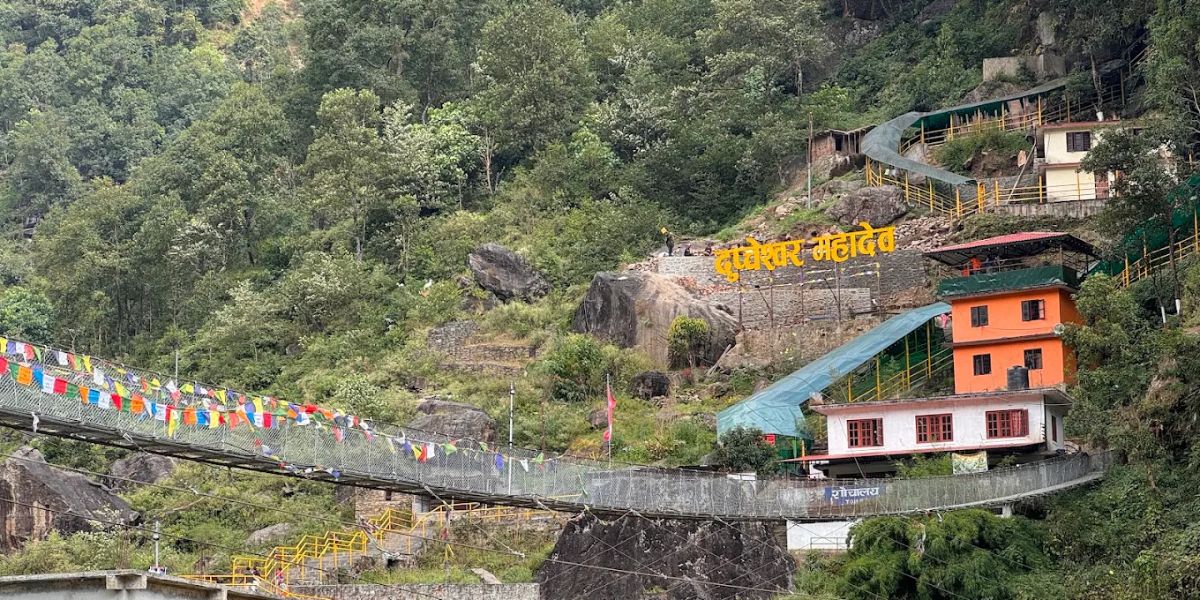
Day 01: Drive from Kathmandu to Talu Village.
- Drive Route: Thamel (or designated place in Kathmandu) > Tokha > Thansing > Chaughada > Samundratar > Dupcheshwor Mandir > Ghyangphedi > Sisipu > Talu Village
- Drive Distance: 85 km
- Drive Duration: 6 to 7 hours
- Accommodation Type: Homestay
Day 02: Trek from Talu Village to Phedi.
- Trek Route: Talu Village > Gopte > Phedi
- Trek Distance: 10 km
- Trek Duration: 6 to 7 hours
- Elevation Gain: 1,300 m
- Accommodation Type: Teahouse
Day 03: Phedi to Gosaikunda Lake via Surakunda/Laurebina Pass.
- Trek Route: Phedi > Phedi High Camp > Suryakunda Lake > Gosain Kunda Lake
- Trek Distance: 6.5 km
- Trek Duration: 6 to 7 hours
- Elevation Gain: 880 m
- Elevation Loss: 230 m
- Accommodation Type: Teahouse
Day 04: Trek from Gosaikunda to Thulo Syaphru.
Day 05: Trek from Thulo Syaphru to Ghoda Tabela.
Day 06: Trek from Ghoda Tabela to Kyanjin Gompa.
Day 07: Tsergo Ri or Kyanjin Ri Hike.
Day 08: Return to Lama Hotel.
Day 09: Lama Hotel to Sano Bharkhu, Drive to Kathmandu.
Note: The distance, duration, elevation change, and accommodation type from Day 04 through Day 09 are the same as the aforementioned Outline Itinerary via Sundarijal.
Both of the aforementioned outlined itineraries are not flood-affected route points, so it is comparatively safer, but that doesn’t mean you can be totally carefree; always be cautious while you're trekking, even if the routes aren’t adjacent to ones affected by the flood.
The only trouble you might feel is that they are a bit longer and can be a bit demanding for beginners.
If not for these trails as well, the trek’s difficulty would have surely gone up, as the only option would be to cross a high pass!
Route #3: Tilman Pass Via Panch Pokhari
This route is not commonly trekked; it is just here as an option for those who want an adventurous trek. The route reaches altitudes higher than 5000 m, which is not suitable for someone just new to trekking or someone who has done 2-3 treks, as the toll it puts on your body is significant.
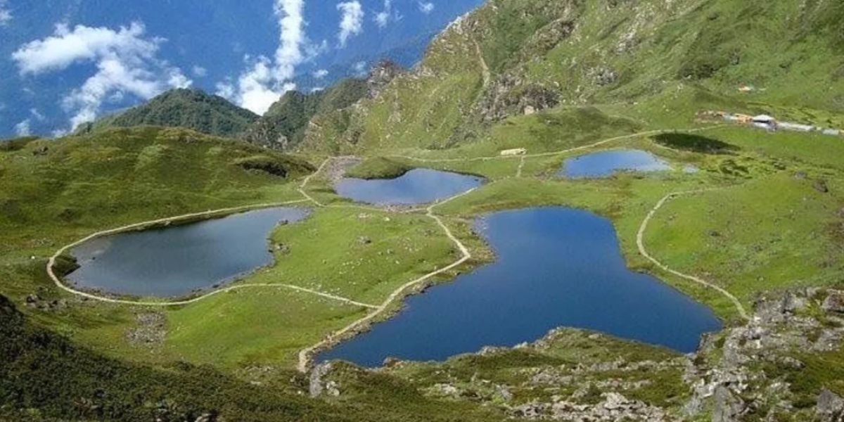
Also, above crossing Panch Pokhari, it becomes a camping trek; there aren’t any teahouses until you reach the Kyanjin Gompa on the other side of the Tilman Pass. So, this trek is for those experienced technical trekkers who dare to take on the challenge.
Outline Itinerary
Day 01: Kathmandu to Chhimti Drive, Trek to Deurali.
- Drive Route: Thamel (or designated place in Kathmandu) > Jorpati > Sankhu > Melamchi Bazaar > Tipeni > Thangpal Dhap > Thulo Bhotang > Chhimti
- Drive Distance: 75 km approx.
- Drive Duration: 5 to 6 hours
- Trek Route: Chhimti > Deurali
- Trek Distance: 1.5 km
- Trek Duration: 1 hrs
- Elevation Gain: 790 m
- Accommodation Type: Teahouse
Day 02: Trek to Nosyampati.
- Trek Route: Deurali > Dukhang Kharka > Tuppi Danda > Tangu Kharka > Rato Mato > Chokhar Danda > Tap Kharka > Nosyampati
- Trek Distance: 11 km
- Trek Duration: 6 to 7 hours
- Elevation Gain: 1,600 m
- Accommodation Type: Teahouse
Day 03: Trek to Panchpokhari, Explore.
- Trek Route: Nosyampati > Saat Ghumti > Pangsing Bisaune > Lauribina > Mani > Panchpokhari
- Trek Distance: 5 km
- Trek Duration: 4 hours
- Accommodation Type: Teahouse
Day 04: Panchpokhari Acclimatization and Exploration Day.
Day 05: Trek to Tin Pokhari.
- Trek Route: Panchpokhari > North Ridge Pass > Tin Pokhari
- Trek Distance: 13 to 15 km
- Trek Duration: 8 hours
- Elevation Gain: 250 m
- Accommodation Type: Tent
Day 06: Trek to High South Camp.
- Trek Route: Tin Pokhari > High South Camp
- Trek Distance: 12 to 13 km
- Trek Duration: 9 hours
- Elevation Gain: 610 m
- Accommodation Type: Tent
Day 07: Trek to Moraine Camp via Tilman Pass.
- Trek Route: High South Camp > Tilman Pass > Moraine Camp
- Trek Distance: 15 km
- Trek Duration: 8 to 10 hours
- Elevation Gain: 450 m
- Elevation Loss: 600 m
- Accommodation Type: Tent
Day 08: Trek to Langshisha Kharka.
- Trek Route: Moraine Camp > Langshisa Kharka
- Trek Distance: 12 to 13 km
- Trek Duration: 8 to 9 hours
- Elevation Loss: 670 m
- Accommodation Type: Tent
Day 09: Trek to Kyanjin Gompa.
- Trek Route: Langshisa Kharka > Numthang > Jatang > Kyanjin Gompa
- Trek Distance: 12 km
- Trek Duration: 6 to 7 hours
- Elevation Loss: 160 m
- Accommodation Type: Lodge
Day 10: Rest Day or Tsergo Ri/Kyanjin Ri Hike.
Day 11: Return to Lama Hotel.
Day 12: Lama Hotel to Sano Bharkhu, Drive to Kathmandu.
Note: The distance, duration, elevation change, and accommodation type from Day 10 through Day 12 are the same as the aforementioned Route #1 and #2.
Feel This Trek Isn’t Safe? Consider These Safer Langtang Options
If you’re having second thoughts about the trek routes that we have mentioned above, then don’t worry; the Langtang Region is stacked with other adventurous treks with minimal risk as per the current situation.
Here is the list of treks that might interest you if you’re looking for other options.
Panch Pokhari Trek (5 Days)
Panch Pokhari Trek, which is also a part of the Langtang National Park, has its own charms that no other trek can replicate. Panch Pokhari is a cluster of five sacred lakes, located at approximately 4,100 m northeast of Kathmandu Valley beneath the magnificent Jugal Himal range.
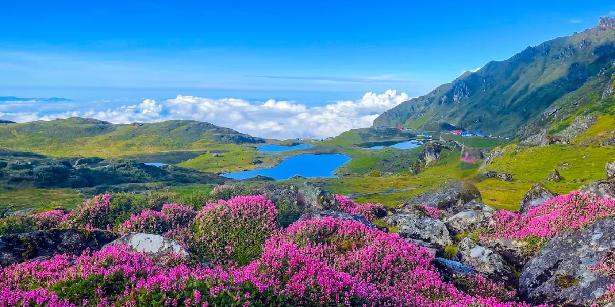
The lakes have a connection with both Hindu and local mountain-deity traditions. The lakes are linked to different stories of Shiva and Parvati in local mythology.
- Different species of birds like Himalayan Monal (Danphe), Blood Pheasants, Snow Pigeons, etc., and wildflowers such as Himalayan Blue Poppy, Himalayan Primrose, Himalayan Edelweiss, etc.
- Five sacred ponds (Panch Pokhari) at an altitude of 4,100 meters above sea level.
- Discover different valleys like Melamchi Valley, glaciers like the Jugal Himal Glacier system, Dorje Lyakpa mountain, and waterfalls in the lower regions of Bhotang, etc.
- A stunning sunrise from 4,300 meters above sea level at Panch Pokhari Viewpoint with a panoramic view of the Jugal Himal range.
- Experience Tamang and Hyolmo culture with a syncretic blend of Tibetan Buddhism and ancient Bon shamanism.
- Musk deer, Himalayan Black bear, Himalayan wild goat, and other wildlife.
- Explore the colorful rhododendron forest between Tuppi Danda and Nosyampati.
Helambu Circuit Trek (8 Days)
Helambu Circuit, another major attraction of Langtang, is quite popular among cultural travelers. This is one of those treks that provide you with the best of both worlds!
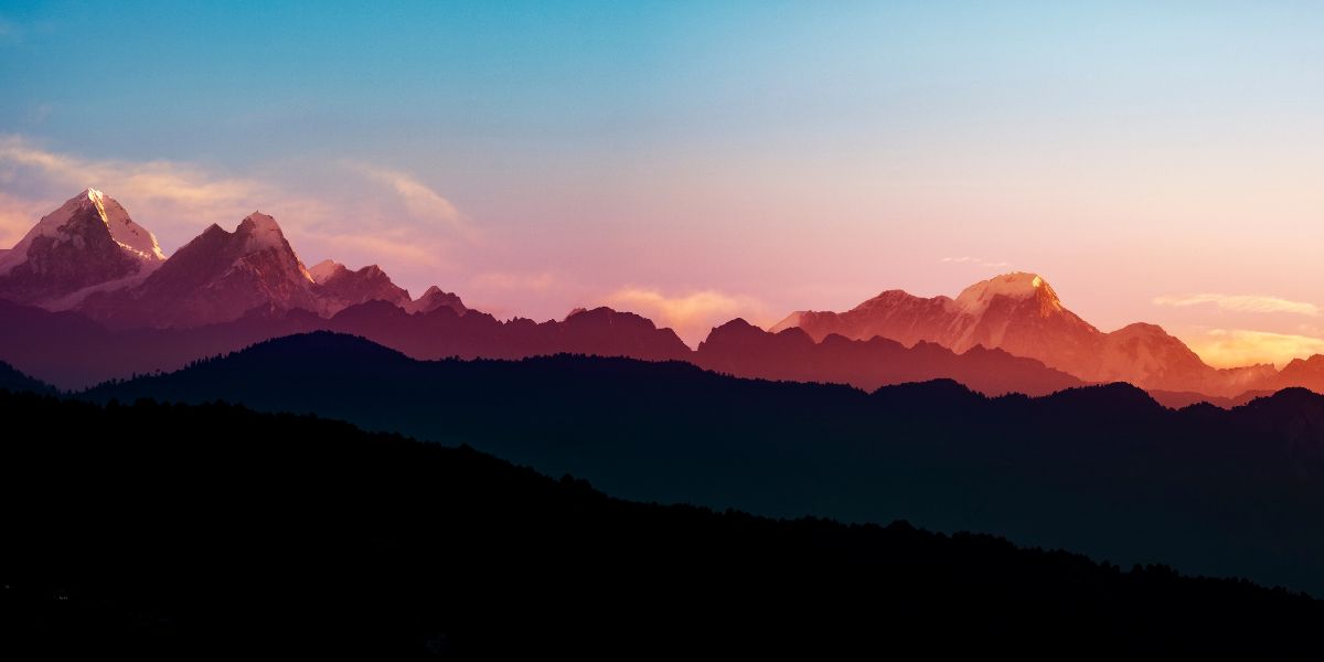
So, you don’t have to choose, as it gives culturally rich insight into the unique Buddhist culture along with Hyolmo and equally rich landscapes and stunning views of snow-capped mountains. You’ll also get past rhododendron forests during the majority of this trek.
Here are the other highlights of Helambu Circuit:
- Witness the vintage monasteries of Helambu, such as Tarkeghyang Monastery, Melamchi Ghyang Monastery, Churi Ghyang Monastery, etc.
- Amazing views of the Langtang, Jugal, Ganesh, Pamari, Rolwaling, and Mahalangur ranges can be witnessed from Thadepati Pass, and on an exceptionally clear day, you get a distant glimpse of Mt. Everest from Ama Yangri Peak too!
- Interact with the locals and learn about Hyolmo culture and tradition (often known as the “Sherpas” of this region), which is different from that of the Khumbu region.
- Walk through beautiful and peaceful rhododendron and oak forests between the settlements of Kutumsang and Thadepati.
Jugal Himal Base Camp Trek (8 Days)
Jugal Himal Base Camp Trek is the newest and most remote route in the region. This trek falls in the Sindhupalchowk district of Nepal.
The Jugal Himal range has positioned itself between the Langtang Himal to the west and the Rolwaling Himal to the east, just along the Nepal-Tibet border. The tallest peak in this trek that you will see is Leonpo Gang (6,979 m), and other prominent peaks include Dorje Lyakpa (6,966 m), Phurbi Chyachu (6,631 m), Gurkarpo Ri (6,891 m), etc.
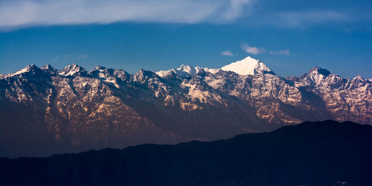
The main highlights of Jugal Himal Base Camp are:
- Get to experience the warmth and beauty of the local cultures of the region, mainly Tamang and Sherpa. As you will go through many Sherpa villages like Tembathang and Bakhang Gompa areas and Tamang villages such as Dukhang, Chhimti, Gyalsing, and Kartike, this will broaden your perspective and knowledge about these communities.
- You will be walking on an ancient trade route, as the trail was once used as a trading corridor between Nepal and Tibet hundreds of years ago.
- Get the chance to experience the beauty of Panch Pokhari if you’re combining your itinerary via the Syaule route, as this lake can also be reached from this route.
- Get to experience beautiful and peaceful Tibetan monasteries such as Bakhang Gompa and Chhandy Gompa.
To learn more about other alternative treks in the Langtang region in detail, you can visit our blog “Best Treks in Langtang Region.”
Safety Tips for the Langtang Trek After the 2026 Flood
After knowing about the catastrophe in more detail, you must be searching for the precautions to take as you’re about to embark on your desired trek in the Langtang Region.
Knowing this, we have made a list of safety tips for you to consider for the Langtang Trek after the 2026 flood:
- Do your own thorough research and verify the access and status of the trails. Always keep yourself updated on the status of the trails and access to roads leading to your trek destination. You can directly contact us to get the latest updates regarding the current situation for the trek or stay posted with the updates from the Nepal Tourism Board.
- An important thing not to miss is trekking with a licensed guide through a reputable and trusted active agency that is well-versed and proficient in Langtang trekking. If you haven’t booked the trek yet and are looking for an experienced and trusted agency to travel with, then our team at langtangvalley.com (from Altitude Himalaya) will be more than happy to guide you through this journey.
- Another thing to watch out for is sticking to an established route and never trying to go off-trail or attempt unofficial shortcuts, as you never know what might happen, and being unpredictable at such a time can do more harm to you.
- Also, have a proper travel insurance plan and always carry extra cash because it never hurts to carry a little more rather than none. And most experienced trekkers know this: carrying money is always a viable option, as online payment is still a rare medium of transaction on these trails.
- Another thing to keep in mind: build maximum flexibility into your plans; keep extra buffer days in your itinerary. It’s a small thing but makes a huge difference!
- Also, build a solid packing list so as to be well prepared for the circumstances at hand.
Final Thoughts: Should You Do the Langtang Valley Trek?
Now, after going through all the information that we have given you, the ultimate question is: Should You Do the Langtang Valley Trek? And the answer totally depends on what you want!
From our side, we think that you should definitely do it if the circumstances are right and favorable. We have mentioned above as well that there are alternative routes that can be used to complete the trek, which are totally safe.
If your gut is telling you to skip it this year, then there’s no pressure; you can do it another time when, hopefully, circumstances have improved in the affected regions. Let’s just hope that the standard Syabrubesi route gets mended as quickly as possible. Until that happens, we have these alternate routes that we need to rely on.
The bottom line is it’s worth giving it a shot if you’re interested and are craving adventure.
Also, if you’re someone who wants to support the region in any way possible after what it just went through with the flash flood, the people of Langtang are more than ever in need of your support.
In fact, without any trekkers on the trail routes, the livelihood of the people will not function properly, as the trekking season here is the main source of livelihood in most parts.
So, if you’re someone who wants to contribute to the community of the Langtang and keep the trekking spirit alive, then there’s no greater reason than this to visit Langtang.
And we have already said the upper parts of the trails haven’t been affected by the flood and are fine for trekking!


 Langtang Valley