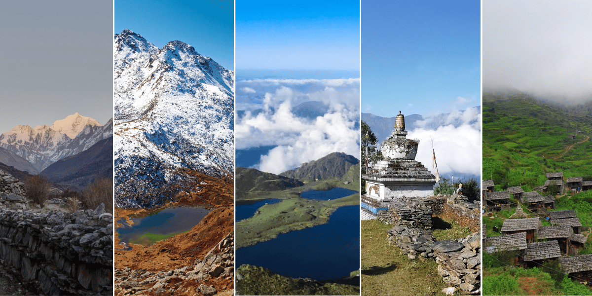
Langtang Region is an umbrella term for the Langtang National Park and its buffer zone. It is a whole network of valleys, ridges, lake basins, and villages.
Here, Langtang Valley, Gosaikunda, Helambu, Panch Pokhari, Jugal Himal, and the Tamang Heritage Trail all form a diverse yet harmonious story of cultures and attractions.
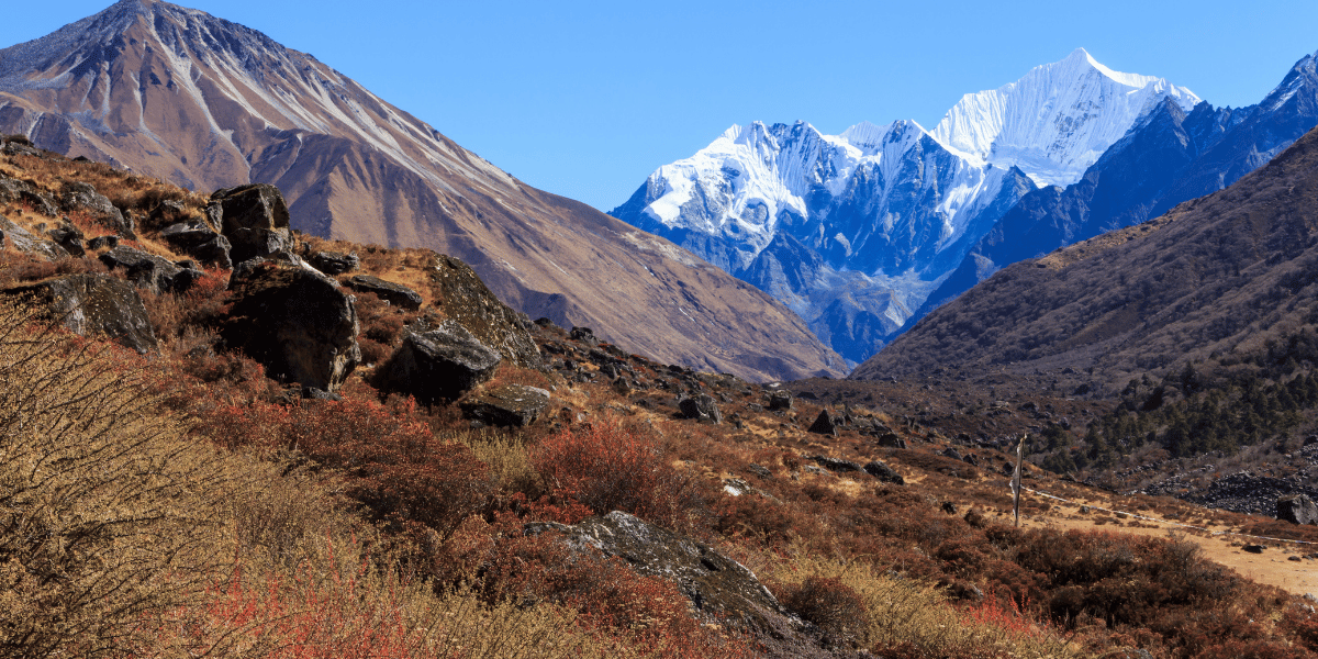
Langtang region is actually one of the closest high-Himalayan trekking regions to Nepal’s capital, Kathmandu. In a matter of days, you can expect to see subtropical river valleys, glaciers, and peaks well above 7,000 meters.
Once you understand what each part of Langtang has to offer, it will become much easier to plan a trip that visits the places you care about the most.
Langtang Attractions Overview
Before going into detailed sections, let's first take a look at how the main attractions are spread on a map of Langtang and its neighboring valleys.
- North–south: The classic Langtang Valley runs roughly north–south from Syabrubesi up to Kyanjin Gompa, ending under Langtang Lirung and its glacier system.
- West: To the west of Langtang Valley, the Ganesh Himal and Ruby Valley side branches off. And the Tamang Heritage Trail loops through Gatlang, Tatopani, Nagthali, and Thuman toward the Tibetan border.
- South: Directly south, ridges climb from Dhunche and Syabru toward the Gosaikunda lake basin and Lauribina La pass, linking further south into Helambu and the Kathmandu-side hills.
- East: To the east, Panch Pokhari and the Jugal Himal front form a quieter ridge-and-lake system that still feels like part of the greater Langtang landscape.
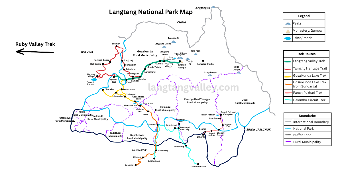
Langtang National Park Map
Langtang National Park is Nepal's first Himalayan national park, established in 1976. It covers about 1,710 square kilometres across Rasuwa, Nuwakot, and Sindhupalchok districts.
The park's altitude ranges from roughly 1,000 m to 7,234 m at Langtang Lirung. This is why you can walk through subtropical forest, temperate oak–rhododendron belts, and high alpine meadows on a single trek.
After Nepal's 2017 administrative restructuring, most of the places you will visit on a Langtang trek fall under one of the following:
Rasuwa District
Gosaikunda Rural Municipality is the largest and most trekking-relevant administrative unit in Rasuwa.
It covers the entire Langtang Valley corridor from Syabrubesi through Lama Hotel, Ghoda Tabela, Langtang Village, Mundu, and Kyanjin Gompa, as well as the Gosaikunda lake basin and the Sing Gompa approach.
If you are doing the classic Langtang Valley trek or the Gosaikunda route, you will spend the majority of your time in this rural municipality.
Amachhodingmo Rural Municipality covers much of the western Rasuwa terrain, including the Tamang Heritage Trail villages of Gatlang, Tatopani, and Nagthali Ghyang.
On the Tamang Heritage trail, you'll also go through Thuman, a part of the Gosaikunda Rural Municipality, which is one of the restricted areas of Nepal. And also Briddim, which is in ward no 3.
Thuman does not fall inside the national park; however, it is still the core part of the Langtang as a whole.
Uttargaya Rural Municipality also covers some of the area of Langtang National Park on the western side of Rasuwa. And certain parts of Kalika and Naukunda Rural Municipalities are also within the Langtang region.
Sindhupalchok District
Helambu Rural Municipality covers the Helambu circuit. Tarkeghyang, Melamchighyang, Sermathang, Kakani, and the surrounding villages lie here. This is the administrative home of the Hyolmo community, and nearly every village on the Helambu trek falls within it.
Panchpokhari-Thangpal Rural Municipality covers Panch Pokhari and its approaches, including the trails up from the Melamchi and the lake basin itself. If you are heading to Panch Pokhari, this is the rural municipality you will be trekking through.
Jugal Rural Municipality covers some of the eastern side of the park and also has some of its parts, located within the Gaurishankar Conservation Area. While Jugal Himal Base Camp can be reached from Panch Pokhari, another route via Bhairab Kunda also exists.
Nuwakot District
Nuwakot's contribution to the Langtang region is mainly with Dupecheswor Rural Municipality and Tadi Rural Municipality at the southern buffer zone of the park.
While you do not have to pass through these parts directly on foot, the district still forms part of the park's administrative boundary and plays a role in park management plus conservation on the southern fringe.
Trekking Routes and Their Attractions
This route features major attractions, from stunning viewpoints to the almighty peaks. All of these are listed below:
|
Attraction
|
Type
|
Route
|
Approx. Elevation
|
|
Kyanjin Gompa
|
Village/Monastery
|
Langtang Valley
|
3,890 m
|
|
Lower Kyanjin Ri
|
Viewpoint peak
|
Langtang Valley (from Kyanjin)
|
4,400 m
|
|
Kyanjin Ri
|
Viewpoint peak
|
Langtang Valley (from Kyanjin)
|
4,700 m
|
|
Langtang Village
|
Village
|
Langtang Valley
|
3,455 m
|
|
Tserko/Tsergo Ri
|
Viewpoint peak
|
Langtang Valley (from Kyanjin)
|
4,985 m
|
|
Langshisha Kharka
|
Alpine pasture
|
Langtang Valley (east of Kyanjin)
|
4,050 m
|
|
Langtang Lirung Basecamp
|
Basecamp
|
Above Kyanjin Gompa
|
4,407 m
|
|
Yala Peak South
|
Easy trekking peak and Viewpoint
|
After Tserko Ri
|
5,520 m
|
|
Gosaikunda Lake
|
Sacred lake
|
Gosaikunda–Helambu
|
4,380 m
|
|
Laurebina / Suryakunda Pass (Lake)
|
Pass
|
Above Gosaikunda
|
4,610 m
|
|
Panch Pokhari
|
Sacred lakes
|
Jugal / Panch Pokhari Trek
|
4,100 m
|
|
Jugal Himal Basecamp
|
Basecamp
|
After Panch Pokhari or via Bhairabkunda, Sindhupalchok route (passing Gaurishankar CA)
|
4,700 m
|
|
Tilman Pass
|
Pass
|
After Panch Pokhari Trek
|
5,350 m
|
|
Ghanja Pass
|
Pass
|
Langtang Valley or Helambu side
|
5,180 m
|
|
Ama Yangri
|
Viewpoint ridge
|
Helambu (from Tarkeghyang)
|
3,772 m
|
|
Gatlang
|
Village
|
Tamang Heritage Trail
|
2,238 m
|
|
Nagthali Ghyang
|
Viewpoint pasture
|
Tamang Heritage Trail
|
3,165 m
|
Mountains, Peaks, and Glaciers of Langtang
Mountains define everything about the Langtang experience. With every route, the scenery shifts significantly.
Langtang Himal dominates the upper Langtang Valley, whereas Jugal Himal has the domain in the eastern regions (Panch Pokhari/Helambu). Ganesh Himal sits to the west (Nagthali Ghyang/Ama Yangri Ridge); however, it is not within the Langtang National Park boundary.
On clear days from Tserko Ri, even Shishapangma appears across the Tibetan border.
The region is nicknamed the 'Valley of Glaciers' due to its numerous glacial bodies, like Langtang Glacier and Langshisha glaciers, which basically shape the entirety of the Langtang region.
Langtang Himal Range
Langtang Himal is the compact sub-range that anchors the entire region, with Langtang Lirung as its most prominent summit. Some of the key Langtang Himal peaks you will see and hear about on a Langtang trek include:
- Langtang Lirung (7,234 m): The highest peak in Langtang National Park, dominating the skyline above Kyanjin Gompa and often called the "signature" mountain of the valley.
- Langtang Ri (7,205 m): Border peak on the Nepal–Tibet border, visible from higher viewpoints like Kyanjin Ri and Tserko Ri.
- Salbachum (6,707 m): Majestic peak at the border of Nepal and Tibet that can be viewed from Kyanjin Ri.
- Yubra Himal (6,048 m): A mesmerising peak that overlooks the mighty Langtang Lirung Glacier and can be seen from both Kyanjin and Tsergo Ri.
- Naya Khanga / Ghanja La Chuli (5,863 m): A technical trekking peak south of the main valley, usually approached via Kyanjin and the Ghanja La area.
- Yala Peak South (5,520m): A popular trekking peak that lies south of Kyanjin Gompa. It is often climbed as an introductory Himalayan summit. On the contrary, the main Yala Peak, which lies in the north, is also accessible, but only a few trekkers complete it.
- Other Peaks: Pem Thang Karpo Ri (6,865 m), Pagri Goldumba (6,620 m), Kyunga Ri I (6,599 m), Dhagpache (6,575 m), Ghenye Liru (6,571 m), Kyunga Ri II (6,506 m), Thakmorpa Ri (6,185 m), Peri (6,174 m), Bhemdang Ri (6,150 m), Thakmorpa North East (5,966 m).
These peaks form the high walls that give the Langtang Valley its "amphitheatre" feel, and they serve as the backdrop for almost every major viewpoint in the region.
Jugal Himal Range
To the east of Langtang Himal lies the Jugal Himal range, a rugged chain of mountains that rises above Helambu and Panch Pokhari and can also be seen from the Langtang Valley.
The major Jugal peaks that you will see and hear of in Langtang include:
- Dorje Lyakpa (6,966 m): A sharp, heavily glaciated peak whose south face towers above Panch Pokhari and the Indravati valley.
- Phurbi Chyachu (6,631 m): Another prominent Jugal peak seen from Panch Pokhari ridges and Helambu high points.
- Jugal Himal / Yangri (6,535 m): A popular mountain in the Langtang region, which can also be seen during the Panch Pokhari Trek.
- Langshisha Ri (6,412 m): One of the striking mountains that can be observed from Tserko Ri.
- Ganchenpo / Gangchempo (6,378 m): A striking pyramid-shaped peak visible from Kyanjin Ri and many higher ridges of the Langtang region.
- Baden Powell Scout Peak (5,857 m): A peak that was renamed from Urkema Peak to honour Robert Baden Powell by the Government of Nepal in 2006.
- Other peaks: Leonpo Gang (6,979 m), Gurkapo Ri (6,891 m), Bhairab Takura (6,799 m), Leonpo Gang East (6,733 m), Gyalzen Peak (6,151 m), and Urkenmang (6,150 m).
As the Jugal Himal camping treks are relatively unknown and have less number of visitors, the landscapes feel uncharted and raw as compared to other accustomed Langtang routes.
Ganesh Himal Range and Shishapangma from Langtang
Although Ganesh Himal and Shishapangma are not inside Langtang National Park, they are major landmarks in the wider Langtang trekking experience because you often see them from higher ridges and viewpoints.
- Ganesh Himal: A separate massif west of Langtang, with the highest peak (Ganesh I) around 7,429 m, visible from Nagthali Ghyang, Ama Yangri Ridge, Lauribina ridges, and some viewpoints of Gosaikunda.
- Shishapangma (8,027 m): The fourteenth-highest mountain in the world, entirely within Tibet, but forms part of the extended Jugal system. It is visible from high Langtang viewpoints, such as Tserko Ri.
At langtangvalley.com, when we design "viewpoint-focused" Langtang itineraries, we often highlight which summits are realistically visible from each ridge so that summit-watchers know what to expect.
All Major Glaciers of Langtang
Langtang is nicknamed the "Valley of Glaciers" and for good reasons. There are dozens of valleys and hanging glaciers that feed its rivers and shape its valleys.
Some of the major and popular Langtang region glaciers include:
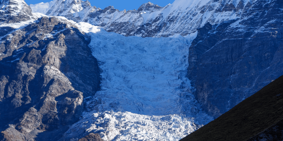
- Langtang Glacier: It is the longest glacier of the region with a measured length of approximately 18 km. It covers roughly 46–50 square kilometres between about 4,500 m and 7,000 m elevation.
- Lirung Glacier: Debris-covered glacier descending from Langtang Lirung toward Kyanjin Gompa; its lower tongue is one of the most visible ice bodies from the village.
- Yala Glacier: A plateau-style glacier used as a benchmark research site, sitting around 5,140–5,690 m near Yala Peak. It is a clear reference for climate-change impacts and is Nepal's first "dead glacier".
- Kimshung (Kimjung) Glacier: A glacier adjacent to Lirung Glacier on the northern flank of the valley. An advanced camp for the Kimshung mountain was set up directly on top of this glacier.
- Langshisha and Shalbachum Glaciers: Large valley glaciers feeding the remote upper Langtang catchment east of Kyanjin Gompa. They shape the dramatic landscape seen from Langshisha Kharka and Tserko Ri.
- Other Glaciers: Ghanna Glacier, Ganchenpo Glacier, Dorje Lhakpa Glacier, Morimoto Glacier, Pangshu Glacier, Ganja La Glacier, Urkinmang Glacier, etc.
Scientific monitoring shows that glaciers like Langtang Glacier and Yala Glacier have been thinning and retreating significantly over the past decades, which trekkers notice as higher glacier snouts, more exposed moraines, and larger meltwater streams in the upper valley.
River Systems and Lakes of Langtang
Rivers in Langtang tell you which way the gradient runs, which valleys are deep enough to hold villages, and where the glacier melt actually goes.
On the main Langtang Valley trail, you follow the Langtang Khola for most of the route, sometimes right beside it, sometimes hundreds of metres above on a cliff path with only the roar audible below.
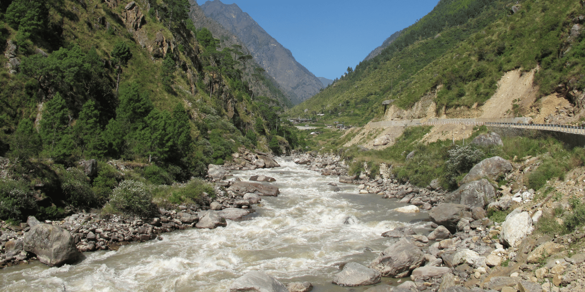
Lower in the region, that same river merges with the Bhote Koshi to form the Trishuli River, one of Nepal's most popular rafting rivers, which you often travel alongside by road on the way from and back to Kathmandu.
Langtang Khola
The Langtang Khola is the main river flowing through the heart of the Langtang Valley.
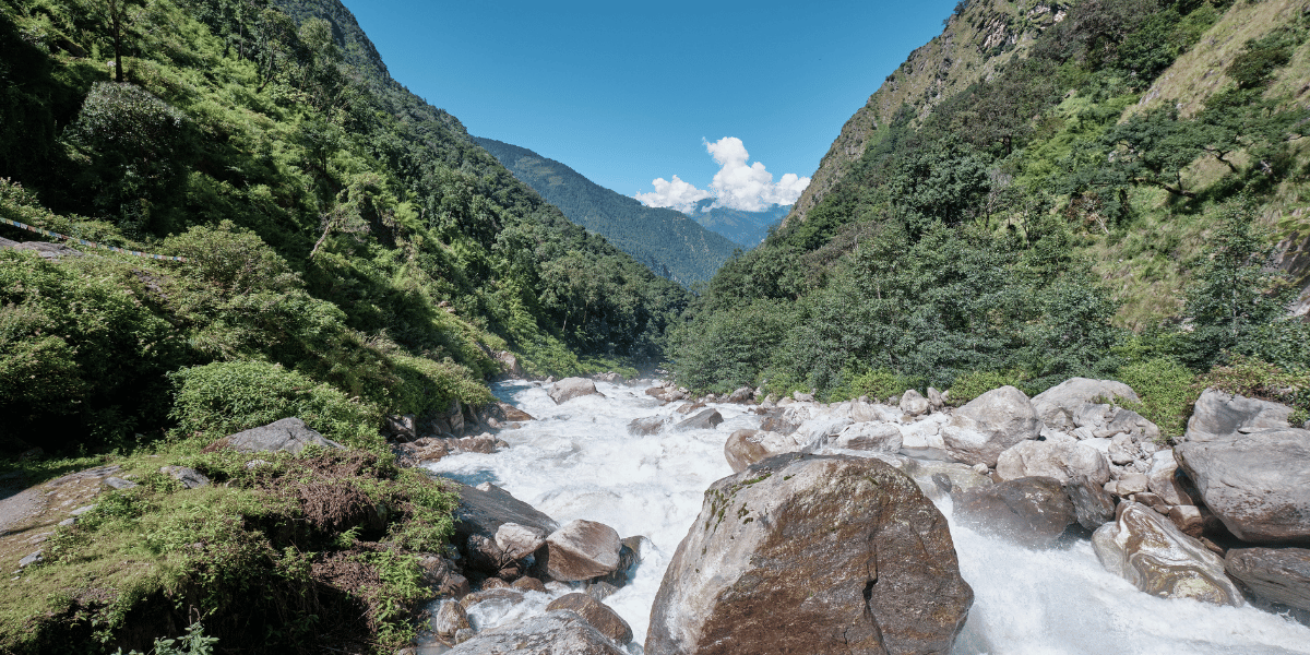
Originating from glacial melt in the high basin above Kyanjin Gompa, it runs past Langtang Village and Mundu, Ghoda Tabela, and Lama Hotel before its water eventually feeds the Bhote Koshi River downstream.
Langtang Khola is fed by Tanmarche Khola, Lirung Khola, Palphu Khola, Chandampari Khola, Kyampu Khola and Chopche Khola at different locations.
Trishuli River
One of Nepal's most famous rafting rivers, fed by meltwater from Langtang Himal, Gosaikunda, and Bhotekoshi, which also mixes with Marsyangdi and becomes the mighty Trishuli.
After which it moves towards the Devghat to mix with the mighty Kali Gandaki, forming the massive Narayani, which later mixes with the Ganges.
The Trishuli River begins effectively from the Gosaikunda lake system and flows south through Rasuwa, Nuwakot, Dhading, Gorkha, Chitwan, and Tanahun before joining the Narayani.
Bhote Koshi River
The name of this river is Bhote Koshi, as it descends from the Bhot a.k.a Tibet, where Kyriong Tsangpo mixes with Lendi Khola somewhere in the Rasuwa Gadhi.
This is the place used historically by traders between Kyirong and the Kathmandu Valley and is still active today.
Another river called Matsang Tsangpo flows from Tibet and reaches Kodari, where it's called Bhote Koshi river yet again.
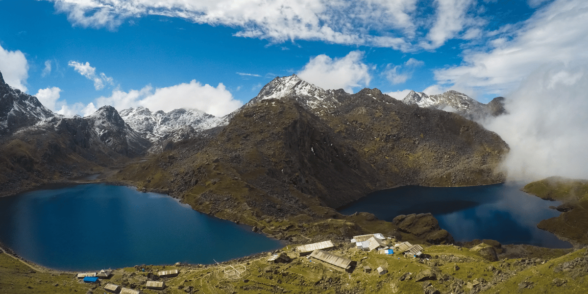
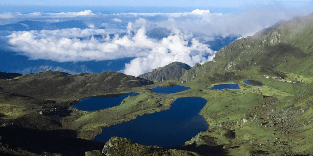
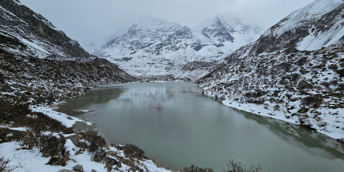
Gosaikunda Lake Complex
Important lakes in this complex include:
- Gosaikunda: The main lake, associated with legends of Shiva piercing the ground with his trident to cool his throat after swallowing poison.
- Bhairav Kunda: A nearby dark-blue lake, often visited in the same circuit and considered powerful but more "intense" in local belief.
- Saraswati Kunda: A nearby small lake that is right below the Bhairav Kunda.
- Surya Kunda: Small lake on the Laurebina side, included in both pilgrimage and trekking loops.
- Other named ponds: Additional ponds, such as Ganesh Kunda, Nilkantha Kunda, Ama Kunda, Ragat Kunda, Barda Kunda, Naag Kunda, are within the broader Gosaikunda basin.
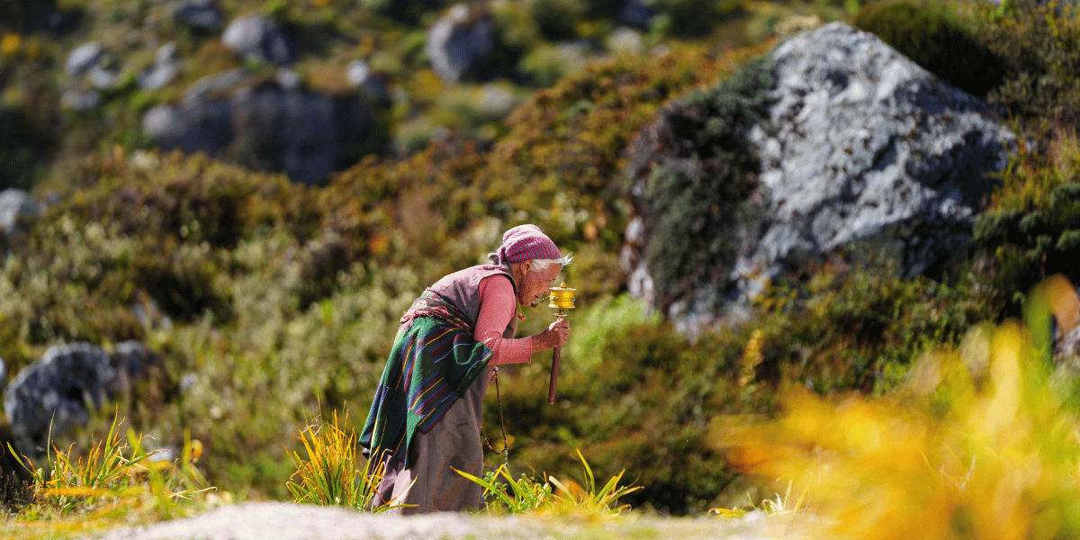
Every August, thousands of pilgrims climb from Dhunche or the Helambu side for Janai Purnima and related festivals, believing that bathing in Gosaikunda cleanses sins; at other times, the area is comparatively quiet and primarily visited by trekkers.
Panch Pokhari (Five Lakes)
Panch Pokhari is a group of five sacred lakes roughly at 4,100 m located northeast of Kathmandu Valley, beneath the Jugal Himal. The lakes are associated with both Hindu and local mountain-deity traditions.
Commonly cited local names for the five ponds are:
- Surya Kunda
- Bhairav Kunda
- Saraswati Kunda
- Ganesh Kunda
- Naag Kunda
The lakes are linked to different stories of Shiva and Parvati in local mythology. There is another river known as the Indrawati River, which is claimed to have a source somewhere near the Shiva Mandir here.
Outside the Janai Purnima pilgrimage days, Panch Pokhari remains relatively secluded, appealing to trekkers who want lakes and long ridges without the crowds of Gosaikunda.
Lirung Glacial Lake
Above Kyanjin Gompa, beneath the snout of the Langtang Lirung Glacier, a small glacial lake around 3,960 m has become well known because it feeds the Kyanjin micro-hydropower scheme.
This lake feeds the Kyanjin Micro Hydro Project, a 100 kW plant that supplies 24‑hour electricity to Langtang Village, Mundu, Sindhum, and Kyanjin Gompa areas. This is actually Nepal's first hydropower project built on a glacial lake.
Parvati Kunda
A small "hidden" lake above Gatlang on the Tamang Heritage Trail, revered locally and associated with fertility legends; reached in about 45 minutes above the village.
Vantage Points and High Passes
Viewpoints in Langtang range from short hikes for acclimatization above a teahouse to full-day ridge climbs that are steep and inclined with a phenomenal view.
Most of the headline viewpoints are approached from Kyanjin Gompa, but Nagthali Ghyang on the Tamang Heritage Trail, Ama Yangri Ridge in Helambu, and the ridgelines above Gosaikunda all offer panoramas that can match anything in Kyanjin.
Passes like Lauribina La, Ghanja/Ganja La, and Tilman Pass are primarily route connectors, but each also doubles as one of the highest and most exposed viewpoints you will cross in the region.
Kyanjin Ri
Kyanjin Ri is one of the most accessible high viewpoints in Langtang Valley Trek, usually reached as a steep half-day hike from Kyanjin Gompa.
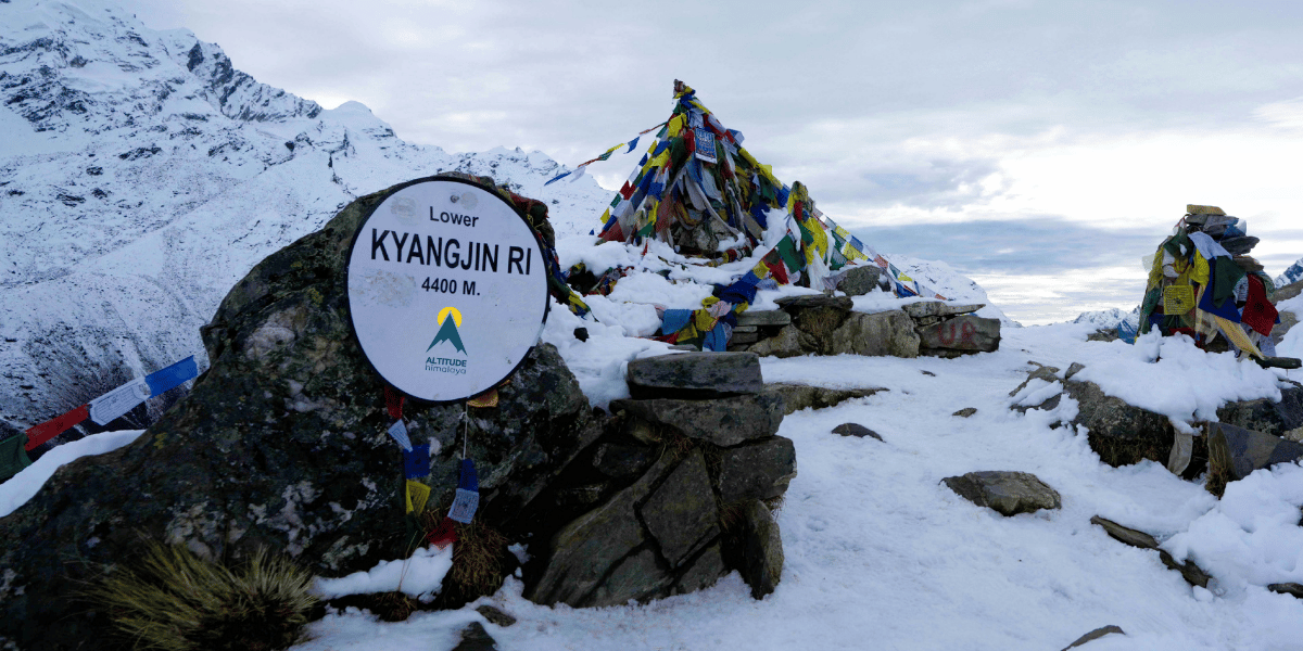
- Elevation: The higher summit lies at an altitude of 4,700 m, with a lower summit, named Lower Kyanjin Ri, lying at around 4,400 m.
- Views: Langtang Lirung, Kimshung (or Tsangbu Ri), Yansa Tsenji, Yubra, Salbachum, Naya Khanga, and a broad sweep of the upper valley glaciers and moraines.
Because it is shorter than Tserko Ri and directly above the village, Kyanjin Ri is often the first acclimatisation or sunrise/sunset hike many trekkers choose.
Tserko Ri / Tsergo Ri
Tserko Ri sits further east of Kyanjin Gompa and is the highest non-technical viewpoint most Langtang trekkers attempt.
- Elevation: It lies at around 4,985 m approx.
- Views: Almost circular panorama including Langtang Lirung, Langtang II, Gangchempo, Dorje Lakpa, Gurkapo Ri, Loenpo Gang, Dorje Lakpa, Ramthang Karpo Ri, and on very clear days, the outline of Shishapangma across the border.
The round trip takes roughly 7–9 hours from Kyanjin Gompa, but the combination of yak pastures, glacial valleys, and summit views makes it one of the absolute highlights of the Langtang Valley Trek.
Thadepati Bhanjyang
Thadepati sits at roughly 3,650 m on the ridge where the Helambu trails meet the routes coming over from Gosaikunda, and it functions as a natural balcony over both Langtang Himal and Jugal Himal.
- Elevation: 3,690 m
- Views: Dorje Lyakpa, part of the Langtang Himal, Ganesh Himal far to the west, and the lower Helambu valleys stretching south towards Kathmandu.
Lauribina La
Lauribina La, at 4,610 m is a high pass that links the Gosaikunda basin to the Helambu region, serving as a gateway between the two major trekking areas.
The climb is steep and prone to snow/ice well into spring and early winter, often marking one of the most physically demanding sections of the Gosaikunda–Helambu traverse.
Ganja La (Ganja Pass)
Ganja La is a challenging and less-frequented high pass primarily used for committed multi-day traverses linking the Langtang Valley with Helambu via remote camping routes.
- Elevation: 5,180 m
- Views: Offers unparalleled views into the inner sanctuary of the main Langtang Himal peaks.
Due to the high altitude, snow, and complex navigation, it is recommended only for experienced trekkers who are accompanied by local guides and are properly equipped.
Tilman Pass
Tilman Pass is a very remote and high pass that links the upper Langtang Valley with the Jugal Himal/Panch Pokhari side. It is suitable for expedition-style traverses rather than standard commercial treks.
- Elevation: 5,350 m
- Views: The surrounding views often include peaks like Gangchenpo, Urkeinmang, Langshisha Ri and Dorje Lakpa.
Crossing this pass requires technical gear and expertise, which makes it a key feature of advanced itineraries for experienced trekkers.
Ama Yangri Ridge
It is a sacred viewpoint ridge above Helambu. While becoming better known, it remains far quieter than the major Langtang region viewpoints. It can be reached in just a 3–4 day trek from the Helambu side.
- Elevation: 3,772 m
- Views: A surprisingly wide panorama of Langtang Himal, Jugal Himal, Ganesh Himal, and even distant Manaslu on clear days.
Nagthali Ghyang
A panoramic viewpoint for a wide range of the Langtang and Jugal ranges, which also falls under the Tamang Heritage Trail.
- Elevation: 3,165 m
- Views: A broad panorama of Langtang Himal to the north and Ganesh Himal to the west, without needing to push above 4,000 m or spend extra acclimatisation days.
Of course, most visitors do not need to cross these passes to enjoy Langtang's main attractions. But if you want a more immersive, personal experience in Langtang, they are easily the master key to making that happen.
Villages, People, and Culture Of Langtang
If mountains are the reason most people come to Langtang, villages are often the reason they remember it. The region has a surprisingly layered cultural landscape for its size.
You have traditional Tamang communities in the lower and middle valleys, a stronger Tibetan Buddhist presence in the upper Langtang, distinct Hyolmo communities across Helambu, and smaller settlements on the Panch Pokhari approaches that blend Hindu and mountain-deity traditions in ways you will not find described in many guidebooks.
Main Villages and Tea Houses of the Langtang Valley
The Langtang Valley trail passes through a chain of villages that change character noticeably as you gain altitude. Let's take a thorough look at these villages:
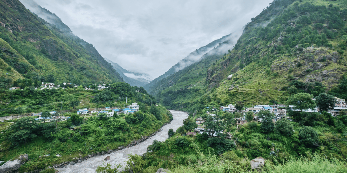
Syabrubesi (1,467 m)
Syabrubesi is the main roadhead for both the Langtang Valley and the Tamang Heritage Trail. It is more of a proper town than most people expect.
It sits at the confluence of the Bhote Koshi and Langtang Khola, which eventually mixes and becomes the mighty Trishuli.
This is basically a busy bazaar, where you'll find regular bus/jeep connections to Kathmandu and a mix of Tamang households plus shops that have been serving border commerce long before trekking was a part of the equation.
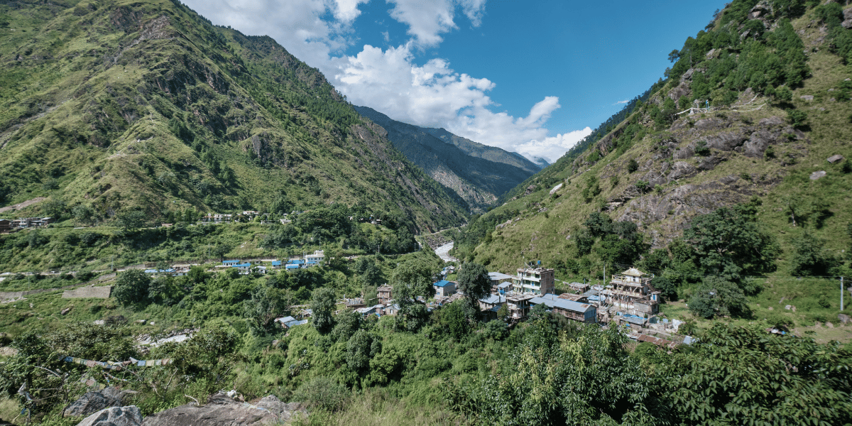
Bamboo (1,984 m) and Rimche (2,495 m)
These are the first settlements after Syabrubesi, and they feel almost entirely different from the roadhead. Bamboo is a small cluster of lodges in a subtropical forest, named for the bamboo thickets lining the path.
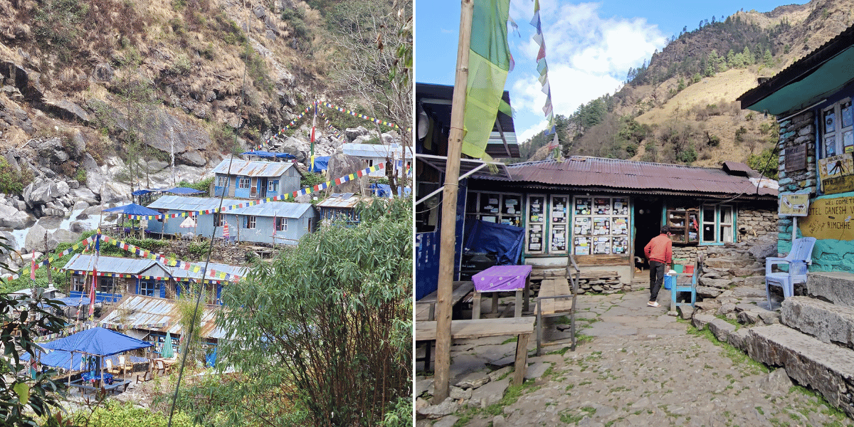
It is also where you first start seeing rhesus and langur monkeys in the trees. Rimche sits a bit higher, still in dense forest, still with the river roaring below.
Lama Hotel (2,515 m)
This is one of those names that trips up almost every first-time trekker. It is not a hotel – it is a cluster of teahouses in a forest clearing, named after the family who ran the original lodges here. Before that, it was called Changdam Village.
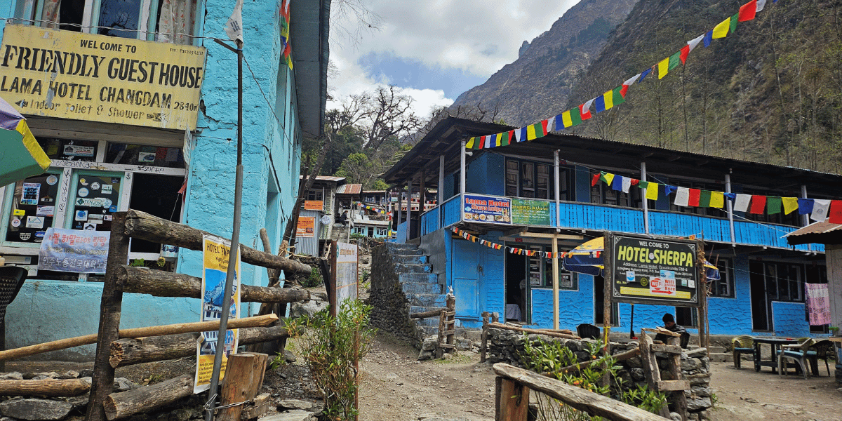
By the time you arrive, the subtropical forest has given way to temperate oak and rhododendron. Here, the Langtang Khola starts to sound genuinely powerful through the gorge far below.
Ghoda Tabela (3,008 m)
The name translates literally to "horse stable". The forest opens up here, and you get your first serious views of peaks above the treeline.
For some trekkers, this is an overnight stop; for many, it is just a tea break before pushing up to Langtang Village or Mundu.
Langtang Village, Mundu and Sindhum (3,455 m, 3,550 m and 3,555 m)
You need a little context to fully appreciate the Langtang Village and Mundu. The original Langtang Village was destroyed on 25 April 2015. When the earthquake triggered a massive avalanche and rockfall, it buried much of the settlement, and even today, around 250 missing people are yet to be found.
The village has been rebuilt about one km further from the affected region. Lodges are open, life continues, and the terraces are farmed again. Walking through it knowing what happened is a sombre and important part of the Langtang experience.
Mundu, a smaller cluster just further up the valley, escaped the worst of the damage and has several lodges of its own.
Sindhum is also another rest stop that can be regarded, since it is just above Mundu and has a cluster of organised aesthetic teahouses.
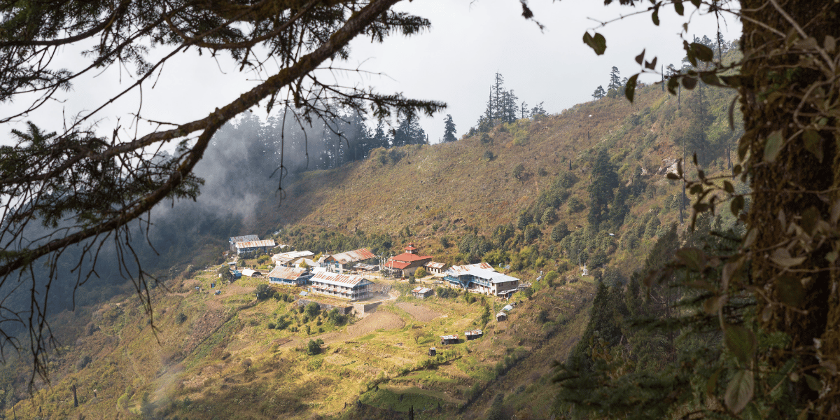
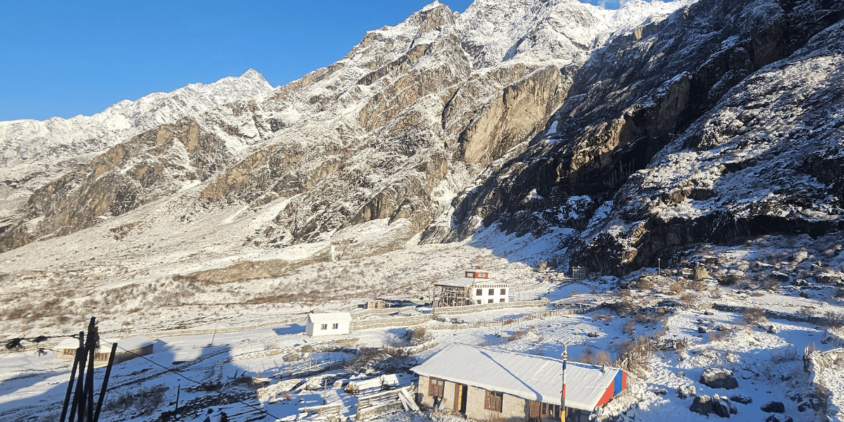
Kyanjin Gompa (3,890 m)
This is where most trekkers base themselves for two or three nights. Kyanjin monastery is located inside Kyanjin Village. The gompa is small with prayer wheels lining the approach path and a view of Langtang Lirung that is nothing short of absurd on a clear morning.
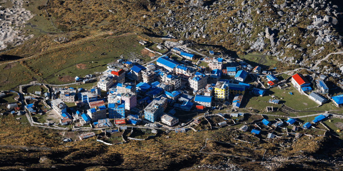
The village also has a yak-cheese factory where you can watch cheese being made and buy it the same day. For most visitors, Kyanjin Gompa functions as the base for Kyanjin Ri, Tserko Ri, Langshisha Kharka, and glacier walks. But, if you have the time, the village itself is worth a slow afternoon.
Gosaikunda Trail Villages/Settlements
Unlike Langtang Valley, the settlements on the Gosaikunda trail are much more basic and primarily meant to serve mostly pilgrims. There aren't big villages, only teahouses that sit above the Trishuli Khola.
Dhunche (1,960 m)
This town is the park headquarters from where you officially enter the protected area of Langtang. Whether you're opting for the Langtang Valley, Gosaikunda, Tamang Heritage, or even Ruby Valley, you'll need to make a stop here to get your national park permit.
From all of the stops, Dhunche is the one where you'll find more established lodges with better amenities. So, it serves as a perfect final night after you come back from the sacred Gosaikunda Lake.
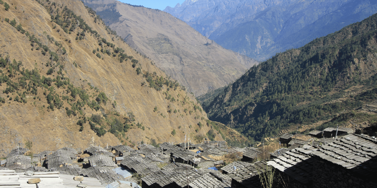
Thulo Syaphru or Thulo Syabru (2,250 m)
This is a proper village that acts as a transition point when heading to Gosaikunda from Langtang Valley. Just like in Dhunche, you'll find proper teahouses here in Thulo Syaphru and the Tamang culture continues to be deeply integrated.
The village itself is spread along a sunny ridge above the Langtang Khola, with old stone-and-wood Tamang houses lined up in rows and terraced fields stepping down the hillside below. On a clear day, you get excellent views of both the Langtang and Ganesh Himal ranges from here.
Chandanbari or Sing Gompa (3,250 m)
This place is named after the monastery that sits at the center of the settlement. This is one of the proper villages that offer good teahouses and lodges on the main foot trail.
There's a local yak cheese factory that is often compared to Kyanjin Gompa's production centre. And reaching here means you've made it roughly halfway to Gosaikunda, 8 km from Dhunche and 8-9 more km to go!
Cholangpati (3,584 m)
This happens to be a much smaller stop than Chandanbari and is home to only a handful of lodges that sit inside rhododendron and pine forest.
There's a new checkpost built here, and since it's the place that connects from Thulo Syabru, you have to show your Langtang permit here as well. If you're doing the combined Langtang-Gosaikunda trek, you'll officially enter the Gosaikunda trail from here, passing via Dursagang.
Villages on the Sundarijal Route
If you plan the Gosaikunda Lake Trek from the Sundarijal side or wish to return via that route, the main villages here include:
- Kutumsang (2,470 m): You'll find terraced fields of millet and paddy in this village, and on clear days you get good views of the Ganesh Himal range.
- Thadepati (3,690 m): This is more like a cluster of seasonal teahouses rather than a village. From here, one trail continues toward Phedi and Gosaikunda, while the other drops east into the Helambu villages.
- Phedi (3,730 m): This is the final stop before the climb to Laurebina Pass and Gosaikunda, little more than a couple of basic teahouses are tucked at the edge. There's also Phedi High Camp (4,220 m), where you'll find a couple of basic teahouses.
Tamang Heritage Trail Villages
On the Tamang Heritage side, the trail loops through a string of villages in upper Rasuwa that sit at a lower altitude and feel warmer, more agricultural, and more culturally immersive.
Gatlang (2,238 m)
Stone and timber houses step up the hillside in terraces; the woodwork on doors and windows shows craftsmanship that clearly goes back many generations.
The local monastery – one of the older ones in the region – sits above Gatlang with a commanding view down the valley.
Tatopani (2,607 m)
The name means "hot water springs" in Nepali, and it delivers on the name. Natural hot springs here have been used by local communities and passing trekkers for as long as anyone can remember.
However, the present state of the hot spring after being damaged by the landslide can sometimes be inoperable. We suggest that you check its status before heading there, or you can connect with us directly, and we are always ready to help you out.
Nagthali Ghyang (3,165 m)
Nagthali Ghyang is the high meadow viewpoint of the Tamang Heritage Trail.
For trekkers who want mountain views but cannot commit to the full Langtang Valley trek, Nagthali Ghyang makes a very strong case for why the Heritage Trail deserves its own visit rather than just being treated as a cultural detour.
Thuman (2,338 m)
Thuman sits near the upper end of the loop in proximity to the Tibet border. The families here maintained close trade and cultural ties with Kyirong for generations.
The Thuman Monastery is always bustling, the houses are more compact and stacked, and the views north toward Shishapangma remind you how close you actually are to the Tibetan plateau. However, being very close to the border with Tibet, this area is restricted.
Briddim (2,229 m)
This is typically the last village on the Heritage Trail loop before you descend back to Syabrubesi.
It has a slightly more open and prosperous feel than the other trail villages, with apple orchards, well-maintained stone paths, and a view down the valley that makes for a good final morning.
Helambu Circuit Villages
In Helambu, the main villages are Hyolmo rather than Tamang, and the cultural atmosphere shifts accordingly.
Tarkeghyang (2,600 m)
Tarkeghyang is the largest Hyolmo village and is more famous and observed in anthropological literature than in trekking guides. The 19th-century monastery here is still actively maintained and used by the community.
Tarkeghyang is also the main base for the Ama Yangri Ridge hike, and even trekkers who do not plan to summit the ridge should enjoy a full day in the village.
Melamchighyang (2,530 m)
This is a quieter Hyolmo village sitting on a ridge above the Melamchi River valley.
It is not as big a village as Tarkeghyang, but it has long views both toward the Jugal Himal snowline and down toward the Melamchi valley.
Sermathang (2,590 m)
Sermathang is on the outer arc of the Helambu circuit, usually reached by trekkers doing the full loop via Mahankal or Talamarang. It is known for its apple orchards and the Tashi Gyalpo Monastery.
The ridge walk between Sermathang and Kakani gives good views of the Jugal Himal front without crazy altitude gain.
Kakani (2,073 m)
This is a small village on the lower Helambu ridge that marks the transition between the Hyolmo cultural zone and the more ethnically mixed lower valley settlements. It is often a start or finish point for the circuit from the Sundarijal or Mahankal side.
Different Ethnic Groups of Langtang
Ethnically, the Langtang region is dominated by Hill Indigenous nationalities, especially Tamang, with local variations by valley.
- Rasuwa District: The 2021 census reports about 46,689 people in Rasuwa, with hill Janajatis making up 78% of the population and Tamang alone accounting for about 69%.
- Helambu Rural Municipality: The 2021 census shows Helambu with around 17,497 people; Tamang are the largest group (54.8%), followed by Hyolmo (17.2%).
- Jugal Rural Municipality: As per the census of 2021, Jugal has a population of 18,303 people, where Tamangs have the highest population (65.5%) yet again.
Trekking and anthropological sources emphasise three main cultural groups along the Langtang routes:
- Tamang: Traditionally, farmers and herders, many with deep historical trade ties to Tibet, their language and rituals are distinct but show strong Tibetan-Buddhist influence in the upper valleys.
- Hyolmo (Yolmo): Buddhist community concentrated in Helambu, often described as closely related to Sherpa groups but with their own language and ritual traditions.
It means you get to encounter Tamang villages that feel almost "Sherpa-like" in the high valley, strongly Hyolmo communities in Helambu, and mixed Hindu–Buddhist communities on the Panch Pokhari approaches.
Main Festivals
Several major festival cycles shape the cultural calendar of the Langtang region:
- Janai Purnima (Gosaikunda and Panch Pokhari): In August, thousands of Hindu and Buddhist pilgrims climb to Gosaikunda and Panch Pokhari to bathe, pray, and change their sacred threads; this is the busiest period on both lake routes.
- Tibetan–Buddhist festivals: The population demographics indicate celebrations such as Saga Dawa and local meals, which combine monastery rituals, masked dances, and community gatherings. Although this valley consists largely of the Tamang ethnicity, most of them follow Tibetan Buddhism, so Gyalpo Lhosar is a major festival in contrast to the other Tamangs of Nepal, who typically celebrate Sonam Lhosar.
- Hyolmo festivals in Helambu: Hyolmo communities celebrate Gyalpo Losar and smaller monastery-based festivals tied to local deities like Ama Yangri Ridge, often with prayer flag renewals and community feasts.
- National festivals: In lower approaches, you may also encounter Dashain and Tihar celebrations with a blend of Hindu and Buddhist practices.
If you enjoy cultural immersion, aligning your trek with one of these festival windows can completely change how the region feels, but you also need to be ready for fuller lodges around the main lakes.
Flora and Fauna of Langtang National Park
Few national parks in Nepal compress as many ecological zones into a single walking itinerary as Langtang.
In one week of trekking, you pass through forests where red panda and grey langurs are common, through dense oak and rhododendron belts, past treeline meadows where yaks graze, and up onto glacial moraines where almost nothing survives.
Plants, Forests, and Medicinal Herbs
Langtang National Park protects an impressive elevational range, which translates into a correspondingly rich plant diversity.
- The National Park is home to over 1,000 species of vascular plants, including several endemic species, with rhododendron, oak, laurel, blue pine, silver fir, and larch forming key forest communities.
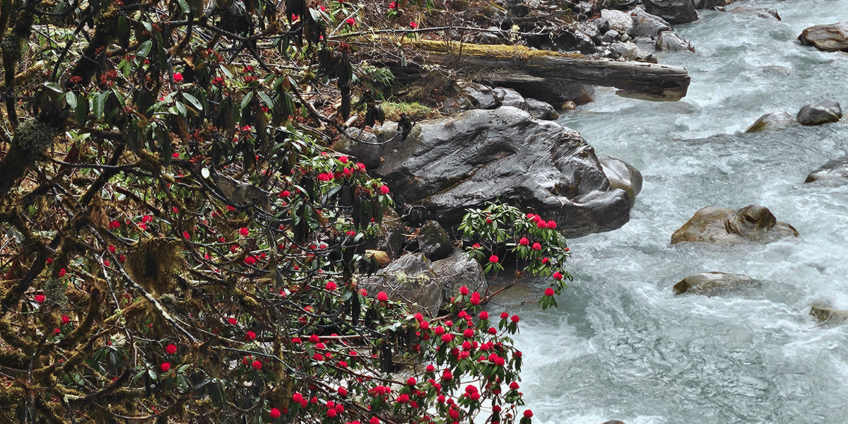
- Spring treks between 2,000 m and 3,500 m pass through spectacular rhododendron forests. The blooms color the trail of the Gosaikunda, Helambu, and Langtang Valley with red, pink, and white blossoms.
Many local guides also point out medicinal and aromatic plants along the way, such as juniper, high-altitude herbs, and wildflowers that carpet meadows in late spring and early summer.
Livestock and Pack Animals
Yaks, yak–cow hybrids (dzo), horses, and mules are everywhere on Langtang's trails.
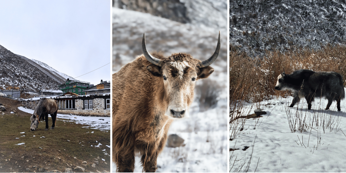
Yak and dzo herds graze on high pastures around Langtang, Langshisha Kharka, and above Helambu, providing milk, cheese, butter, and meat for local households and lodges.
On lower sections, mules and horses carry supplies between roadheads like Syabrubesi and villages further up, especially in peak trekking seasons.
Common and Rare Wild Animals
Wildlife is one of the major highlights of the Langtang region.
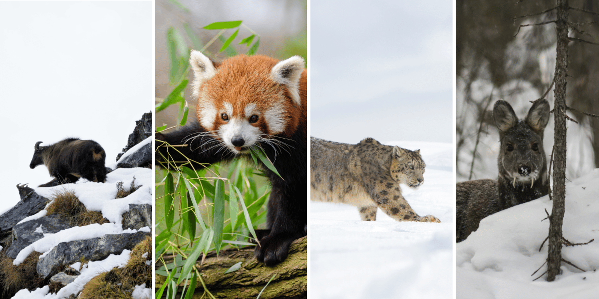
- Official park and conservation summaries list at least 46 mammal species, including red panda, snow leopard, Himalayan tahr, musk deer, Himalayan black bear, goral, serow, langur and rhesus monkeys, wild dog, and others.
- On the trek, trekkers most commonly see langur monkeys, Himalayan tahr, musk deer, and small mammals like pikas. Red pandas and snow leopards are present but rarely seen without specialized tracking.
If you walk quietly, early mornings and late afternoons in forest and meadow zones are the best times for wildlife sightings.
Birdlife and Himalayan Avifauna
Langtang is also a very well-suited destination for bird-watchers.
The Nepal Tourism Board notes 373 bird species recorded in the park, including Himalayan monal (impeyan pheasant), satyr tragopan, snow partridge, crimson horned pheasant, ibisbill, and many others.
Spring and autumn offer the best combination of visibility, migrant activity, and manageable weather for birdwatchers.
Hidden Gems in Langtang Region
Beyond the "headline" attractions, there are quieter spots that often become people's favourite memories. If you prefer solitude over big crowds, our team often suggests adding at least one of these side trips to an otherwise "classic" Langtang itinerary.
- Langshisha Kharka: Remote pasture east of Kyanjin Gompa at around 4,050 m. It can be reached via a long day hike or overnight camping. It is surrounded by glaciers, with views toward Langshisha Ri, Dorje Lakpa, and other peaks.
- Lirung Glacier Viewpoint: The viewpoint stands at an altitude of 4,160 m, where the enormous Lirung glacier garners a spectacular view that amazes every person who ascends to this viewpoint. It is a fairly easy trek and can help you acclimatise for the higher altitude treks.
- Langtang Lirung Base Camp: Base camp area for the 7,234 m Langtang Lirung lies around 4,407 m and is, of course, used by climbers for their summits. Advanced trekkers sometimes visit it as a demanding side trip from the main valley.
- Timure and Rasuwa Gadhi (approx 1,800 m): The last major Tamang village before the Nepal–Tibet border at Rasuwa Gadhi. This Timure town has its own hot springs, an old monastery, and a distinctly frontier character. This is a working border crossing, one of the main trade routes between Kyirong Town and the Kathmandu Valley. If you are already on the Tamang Heritage Trail and have an extra day, continuing to Timure and walking back is an easy extension that most people do not know to ask for.
- Lower Helambu as a standalone circuit: The loop from Sundarijal or Melamchi through Chisapani, Pati Bhanjyang, Thadepati, and back down via Tarkeghyang and Mahankal is one of the best short treks near Kathmandu that almost nobody thinks about. You do not go above about 3,600 m, you sleep in Hyolmo villages, and you get real Himalayan scenery without the altitude commitment of Gosaikunda or Langtang Valley. And, above all, it is rarely crowded outside of the main festival days.
Best Ways to Explore Major Attractions
There is no single "correct" way to see Langtang's major attractions – the right approach depends on your time, fitness, and interests.
Classic Trekking Routes
Since the need to explore is different for different people, and some of the safer options that people are inclined towards become the classic routes over time.
- Langtang Valley Trek: Typically around 10 days from Kathmandu and back, starting at Syabrubesi, passing Lama Hotel, Langtang Village, and Mundu, and finishing with several nights in Kyanjin Gompa for side hikes to Kyanjin Ri, Tserko Ri, Langshisha Kharka, or the Lirung glacial lake.
- Gosaikunda Lake Trek: Usually 7–13 days, depending on start point (Dhunche, Thulo Syabru, or direct approach from Kathmandu); reaches Gosaikunda and optionally crosses Lauribina La toward Helambu.
- Tamang Heritage-Langtang–Gosaikunda–Helambu Traverse: A 19-to-21-day journey that links Langtang Valley, Gosaikunda, and Helambu into one continuous route, crossing Lauribina La and exiting near Sundarijal or Melamchi.
- Tamang Heritage Trail: A 10-to-14-day culture-focused loop through Gatlang, Tatopani, Nagthali Ghyang, Thuman, and Briddim after being combined with Langtang Valley.
- Panch Pokhari Trek: A 6–12‑day camping or lodge-supported trek from Bhotang above Melamchi to the five lakes under Jugal Himal.
- Tilman Pass Trek: An adventurous 10-12-day trek that accommodates a high pass and camping trek with an abundance of remoteness, which connects the Langtang Valley with the Panch Pokhari-Thangpal Region.
- Ganja la Pass Trek: One of the mightiest trails in the extended version of Langtang Circuit, which has the highest point at 5,106 m and can be completed in a span of 12-14 days.
- Helambu Circuit Trek: A 10-to-12-day trek popular among cultural trekkers, which provides a unique Buddhist and Hyalmo culture. Furthermore, it also showcases mesmerising landscapes of Gaurisankhar, Langtang Lirung, Ganesh Himal and Mount Everest (On clear days).
Helicopter Tours and Short Trips
If long treks are not possible, helicopter tours to Langtang Valley can land near Kyanjin Gompa, giving you a direct look at Langtang Lirung, nearby glaciers, and the village in a very short time frame.
This doesn't replace the slow rhythm of trekking, but it is a valid way for time-constrained or less mobile travellers to experience the valley's core scenery.
Peak Climbing and Technical Routes
For those wanting more commitment and altitude:
- Yala Peak: Popular easy trekking peak near Langtang Valley, often combined with a standard Langtang itinerary.
- Langshisha Ri, Naya Kanga, and other technical summits: More demanding climbing objectives for experienced mountaineers, typically approached via extended expeditions and guided teams.
- Jugal Himal and Tilman Pass traverses: Advanced camping routes linking Panch Pokhari, Bhairav Kunda, and Langtang/Helambu that require solid logistics and comfort with remote travel.
- Langtang Lirung and Langtang Ri: These are the true 7000-meter expeditions that require separate permits and multiple other regulations to be followed.
If you are considering peak climbing in Nepal, we strongly recommend proper acclimatization and professional guiding; the terrain and altitude are serious even if the peaks are not eight-thousanders.
To learn more about permits, go through our detailed Langtang Trekking and Expedition Permits guide.
Seasonal Highlights of Langtang
The same attraction can feel completely different depending on the season, and the month you travel also affects the overall difficulty.
Spring (March - Mid June)
Spring brings comfortable daytime temperatures at mid-altitudes and cold but manageable nights. Rhododendron forests explode in colour between 2,000 m and 3,500 m, and birds and wildlife are particularly active.
- Best for: Langtang Valley, Gosaikunda, Helambu, Tamang Heritage Trail, and Panch Pokhari when you want a mix of forest colour, snow lines on peaks, and lively villages.
- How attractions change: Kyanjin Ri and Tserko Ri look especially dramatic with fresh spring snow on the high summits, while Gosaikunda and Panch Pokhari may still have snow patches or partial ice.
Monsoon (Late June - Mid September)
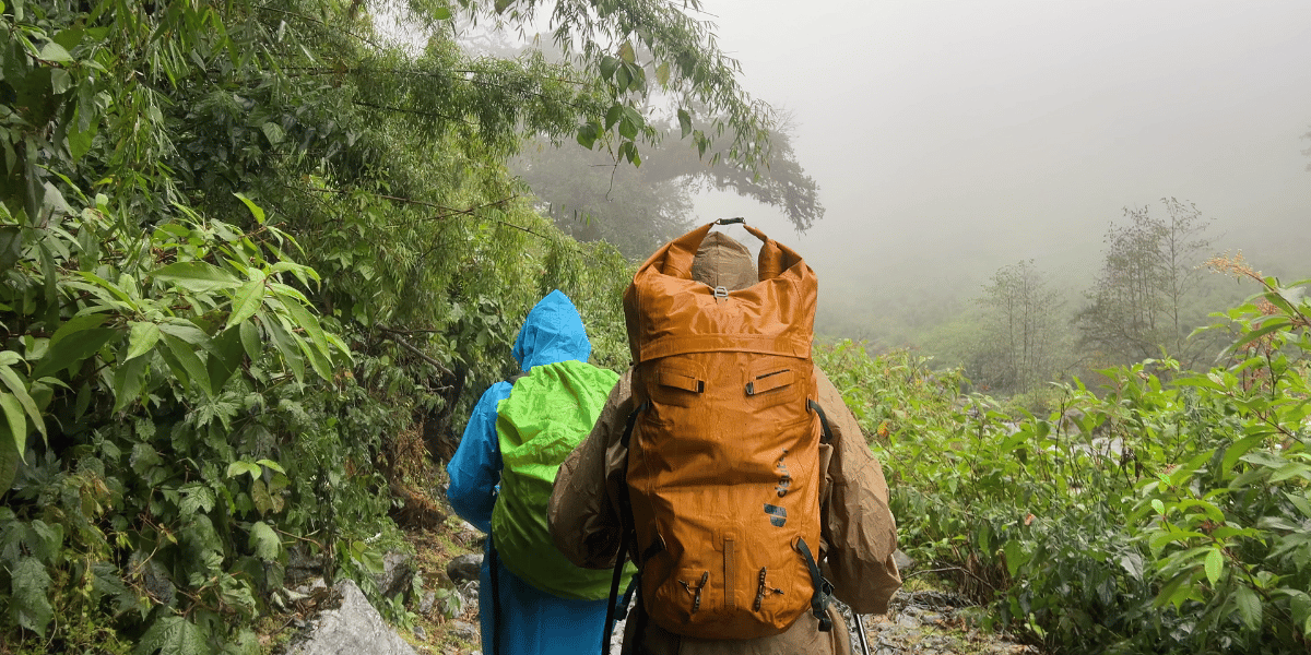
In the monsoon, heavy rain is a given, but it also means lush green forests and wildflowers in the grazing pastures. On the other hand, views are often obstructed by frequent clouds, along with leeches at lower elevations and increased landslide risk.
- Best for: Cultural and village-focused trekking in lower Langtang and Tamang Heritage Trail, plus attending Janai Purnima pilgrimages at Gosaikunda or Panch Pokhari if you are prepared for mud and crowds.
- How attractions change: Forests and waterfalls are at their most intense, while high viewpoints like Kyanjin Ri and Tserko Ri can be hit-or-miss for clear panoramas; Gosaikunda and Panch Pokhari are packed during festival days but almost empty outside them.
Autumn (Late September - Mid December)
Autumn is widely considered the prime trekking season in Langtang, with post-monsoon clarity, stable temperatures, and long sequences of blue-sky days.
- Best for: Big mountain views from Kyanjin Ri, Tserko Ri, Lauribina La, Panch Pokhari ridge, and Ama Yangri Ridge, plus multi-route traverses like Langtang–Gosaikunda–Helambu.
- How attractions change: Lakes like Gosaikunda and Panch Pokhari are usually ice-free and intensely blue; ridges are dry and firm underfoot; and distant ranges such as Ganesh Himal, Manaslu, and even Annapurna or Gaurishankar are more likely to appear on the skyline.
Winter (Late December - February)
Winter brings quiet trails, very cold nights, and some of the sharpest mountain views of the year when skies are clear.
- Best for: Lower Langtang up to Kyanjin Gompa when lodges are open, Tamang Heritage Trail villages, lower Helambu, and possibly frozen-lake visits to Gosaikunda or Panch Pokhari for well-prepared and guided trekkers.
- How attractions change: Gosaikunda and Panch Pokhari can be frozen or partially frozen, giving a completely different aesthetic; Kyanjin Ri and Tserko Ri may require microspikes or crampons; and some high passes like Lauribina La or Ganja La can be unsafe in winter conditions.
Travel Tips to Explore Langtang the Best Way
Planning your Langtang trip wisely can make the difference between a rushed slog and a deep, rewarding experience in the valley. Give yourself enough time, respect the altitude, and treat the region as locals' home rather than just a backdrop.
- Give yourself enough days: Even the classic Langtang Valley trek is best done over 7-10 days, so that you can climb gradually from Syabrubesi to Kyanjin and add at least one acclimatisation day before attempting Kyanjin Ri or Tserko Ri.
- Be wary of Altitude Sickness: As a trekker, you should also be aware of the signs of altitude sickness (such as headache or nausea) and descend if symptoms persist, as this is critical for safety at high elevations.
- Adapt and rest: If you want to link Gosaikunda and Helambu along with Langtang valley, plan for around 12-16 days. This way, your body will have enough time to adapt before you sleep above 4,000 m.
- Include buffer days: Langtang's changing demand requires one or two buffer days in your itinerary for weather, minor illness, or trail delays. Having too tight a schedule usually results in more harm than good.
- Carry enough cash: In this region, card and online payments are usually unavailable or unreliable. You can find an ATM on the trail, like in Kyanjin Gompa during the Langtang Valley Trek, but there is a possibility it won't work. So, cash is the only reliable payment method, and it's recommended to carry at least the expected expense amount with you in cash.
- Carry power banks: Due to common network issues and potential power outages on trail sections and some settlements, adding power banks or electricity-related backups to your packing list is a must for a smooth trip.
- Stay informed on weather conditions: Over the years, studies and local experience both show clear patterns of more erratic snowfall, heavier downpours, and shifting monsoon patterns. These conditions make high passes unsafe and sometimes can be hazardous.
- Support the local economy: Remember that you are walking through places people call their homes. Local experiences define your immersion levels. So, you will get the best out of your stay if you stay in locally owned lodges, eat local foods, and hire local guides and porters. By doing so, you can also help boost the local economy.
- Be present and attentive: Simple gestures like learning a few local phrases, walking clockwise around chortens, and asking before photographing people or religious objects will show that you are present and that you respect Langtang and its people.
Final Thoughts / Conclusion
When you look at Langtang purely on a map, it is a cluster of valleys and ridgelines north of Kathmandu. When you walk it, it becomes a dense collage of glaciers, sacred lakes, red-panda bamboo forests, stone villages, and quiet monasteries under the watch of peaks like Langtang Lirung and Dorje Lakpa.
Whether your Langtang story centres on standing on Tserko Ri at sunrise, circling prayer wheels in Kyanjin Gompa, sharing tea in a Gatlang homestay, or watching pilgrims bathe in the icy waters of Gosaikunda, the attractions we have covered here are the building blocks of that experience.
If you would like help turning this into a concrete itinerary, be it a short Langtang Valley trek, a lake-focused journey, or a full Langtang–Gosaikunda–Helambu traverse, our team is always happy to map out the route that fits your trekking style and budget best. Happy travelling!

